
3pm Sunday: Update on Next California Storm
There will be periodic snow in the mountains and scattered showers elsewhere for about the next 24 hours. The current radar, from 2:56pm PDT, is somewhat typical.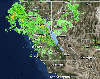
The thin brown lines are "isobars," which are lines of equal barometric pressure. They are relatively far apart at this time. When the isobars are closer together, other factors equal, there is more wind.
 The yellow is heavy rain, in the red areas very heavy rains with thunderstorms. Low how close the isobars are: It looks like this next system will be windier, perhaps much windier, -- with corresponding power failures -- than Friday's system.
At 11pm Tuesday, freezing levels will be dropping in the mountains with blizzard conditions continuing, especially near I-80. Heavy to torrential rains will continue in Southern California. Flooding will be developing that will last well into mid-week.
 However, this evening, a Hurricane Hunter aircraft will fly through the approaching AR and special weather balloons will be launched. That means the data will be of better quality late tonight and Monday morning. That means we should be able to give more precise precipitation amount forecasts.

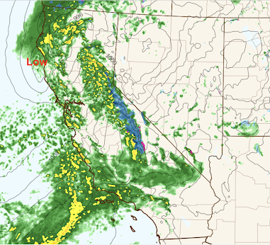
However, Monday night into Wednesday morning, another atmospheric river (AR) will move into the Golden State. Below is the forecast radar for about 9pm Monday.
 |
| PolarWx |
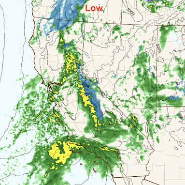
And, by 7am Tuesday, the forecast radar looks like this:

At 11am Tuesday, the low pressure system is near the NorCal coast. The freezing level is higher XX

The freezing level will be higher with this storm, so rain will be falling in the foothills and in lower elevations. Where the snow is falling, there will be blizzard conditions at times. Very high winds will be continuing, especially in the Sierra. This is also about the time when heavy rain begins in the Southland.

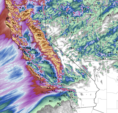
The preliminary precipitation totals should look like this.


You are welcome to follow me on Twitter for updates @usweatherexpert .
Addition: The NWS has come out with its advisory. It is very similar to mine, but please take a look. You'll find it here.


Comments
Post a Comment