wonderful story about Fr. Emil Kapaun today. He was both secular hero, given the Medal of Honor by President Obama, and will likely (in my opinion) be declared a saint by the Catholic Church for, literally, giving of his life to help his fellow prisoners during the Korean War.
My children went to Kapaun High School. The memorial to Fr. Kapaun in the school's rotunda is simultaneously uplifting and sobering. One wonders how he could physically do everything he did in the prison camp. Clearly, God was with him.
Hat tip: Roy Wenzl of the Wichita Eagle who has done outstanding work in reporting the story of Fr. Kapaun's life. There are many more stories about Fr. Kapaun here.
Saturday, May 31, 2014
Weekend Severe Weather Outlook
Today and Tonight:
Fifteen percent is the significant threshold. This is where damaging winds of 60 mph or more are forecast to occur along with large hail.
Sunday and Sunday night:
Again, the significant threshold is 15%. The hatched area is where hail 2" in diameter and wind gusts of 75 mph are possible.
More severe thunderstorms are forecast next week. Stay tuned.
A Great Book For Father's Day
There are few things that bring more pleasure than a great book. This is especially true when on vacation. So, get Dad a book with an uplifting, true story that he'll love wherever he happens to be.
Friday, May 30, 2014
Some Thoughts About Entrpreneurship
Recently, there have been a number of articles about the rapidly diminishing rate of formation of new businesses in the U.S. I guess because I have been a successful entrepreneur, I have been asked, several times, about this. While I don't consider myself an expert in business, I agree with expert David Mitchell's comments.
Rainfall Amount Forecasts
Below is the rainfall amount forecast for the next seven days:
Taking things out an additional three days, here is the European Model's ten day rainfall forecast:
It is my opinion the wet pattern for the central Plains will continue to at least the 15th of June, a few days beyond the European map.
![]() |
U.S. National Weather Service |
![]() |
Dr. Ryan Maue |
"Heads Up" for Next Week
Forecaster Evie has been diligently studying the latest weather information and soil saturation data and wants to let you know that she is very concerned about severe thunderstorms (tornado, large hail, damaging straight-line winds) and flooding developing next week, especially in the central third of the U.S.
It has been a mild spring weather-wise, so don't be lulled into complacency. Evie, assistant forecaster Elmo, and I will be keeping an eye on things and will provide plenty of updates here on the blog.
Needed Rains; Unneeded Rains
Seven day forecast rainfall. South and west of the Missouri River, most of the rain is needed and helpful. To the east? Not so much.
Thursday, May 29, 2014
Global Warming: Is There Anything It Can't Do??
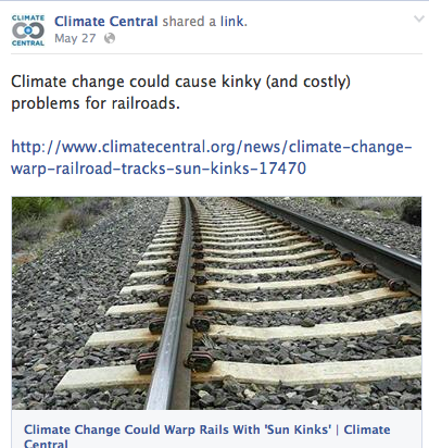
Now, it is sun kinks on railroad tracks:
They are called "sun" kinks for a reason. It is the sun that excessively heats the rails more than just the temperatures.
Yesterday, it was global warming causes more infidelity. Today, sun kinks. Tomorrow, it will be
green monsters from outer space.
ADDITION:
Over on Facebook, I heard from a climate scientist who questioned whether the sun could heat exposed metal rails to a higher temperature than the air temperature. The answer is absolutely, yes! Because meteorologists want to measure the temperature of the air, official thermometers are sheltered from the sun by putting them into louvered boxes painted white. An example is below.
Otherwise, the thermometer would be measuring the radiant heat of the sun rather than the temperature of the air. I suspect that Climate Central, like our climatologist friend and so many other climatologists, don't know the basics of meteorology which is why so many incorrect statements are made.
![]() |
NOAA |
Review: MOVE Live on Tour
Jullianne and Derek Hough opened their national tour in Wichita yesterday evening and it was great fun. The show is Vegas-y in a good way. Well produced and executed with plenty of audience interaction. My only complaint is the mildly risqué jokes between the two stars seem awkward when done by brother and sister.
I see that most of the upcoming shows are sold out, but if you do not have your tickets yet, I have a couple of recommendations.
Get tickets on the floor (they go into the audience) or in elevated seats farther back in the center. We were off to the side and, while we had a great view, a number of the "bits" were hard to see from the side.
Do not sit in the first 2 to three rows. Their stage is higher than some and I imagine it would be uncomfortable to see the entire stage.
I give MOVE 4.5 stars.
Global Warming: Is There Anything It Can't Do?!?!
A new report blames global warming for
rising rates of infidelity
I wonder, when Al and Tipper broke up, if Al tried to rationalize his infidelity by telling Tipper, "global warming made me to it."?
Wednesday, May 28, 2014
Lightning Safety!!
Watch the entire video, first…I'll wait.
The lightning struck him and the pavement. You can see pieces of pavement and dust launched by the force of the lightning bolt. The lightning disabled his car's electronics.
From the video, it appears to me the bolt came from the thunderstorm's anvil (interesting explanation here) away from where the rain was falling.
Sunday, I was in my backyard photographing thunderclouds and I heard the familiar "zip" sound of "anvil crawler" lightning overhead. While most anvil crawlers are horizontal (see below), they sometime induce cloud to ground lightning and they are nearly impossible to see in full daylight. I walked very quickly back into the house because it is not safe to be under anvil crawlers. An example of a cloud-to-ground bolt induced by an anvil crawler is below.
![]() |
Wikipedia, click to enlarge |
Tornado Approaching? What to Do?
Caution: Unfortunate, strong language.
Many people have sent this video from Monday in North Dakota where a tornado struck a "man camp" -- a compound of mobile homes used by oil workers. There was no tornado shelter.
In a case like this, my recommendation would be to drive south (90°) away from the tornado that was approaching from the west. Here's why:
- There was no tornado shelter.
- A new model pickup truck (with airbags) is safer than a mobile home. Both can roll but a pickup has no refrigerators, sofas, etc. to fall on top of you.
- It is rural area with no traffic, so a reasonable escape speed could be attained relative to the speed of the tornado.
Important note: I would not recommend fleeing in every instance. But, since I was asked what I would do in this situation, that is my suggestion.
Seven Day Rainfall Forecast
The slow moving low pressure system that brought the needed rains (below) to the drought region is expected to bring as much as seven additional inches to Louisiana. The weather pattern is shifting to one of thunderstorms in the northern Plains this weekend and the first of the week.
Below is the observed rainfall for the past seven days. While more rain is needed in most areas, this is the first significant relief in months.
Tuesday, May 27, 2014
Forecaster Evie Has a Summer Reading Recommendation
While an accomplished forecaster who correctly forecast some of this spring's tornadoes, she wants to read about heroic meteorologists who have saved tens of thousands of lives by creating America's unique storm warning system. It is uplifting, fascinating reading -- Evie wouldn't bother with anything else! You can get your copy here.
[500] Days Till Perpetual Summer
Since posting an item on Facebook about Secretary of State John Kerry and the French President's claim that we only have 500 days left until the climate apparently goes Ka-Blooey (actually we are now down to 482 days, 12 hours, and 30 minutes) a number of you have written asking if I could put a countdown clock on the blog. Just want to let you know I am looking into it.
Meanwhile, you might want to stock up on popcorn and your favorite beverage as 2015's crop will not be in before September 21, 2015, the "climate chaos" (their words) caused by global warming day. It should be fun to watch!
More Tax Dollars Spent on Global Warming Nonsense
The U.S. is trillions of dollars in debt and we are spending money on this?
Today's Texas Tornado Risk
Five percent is the significant threshold and it includes the DFW Metroplex, Austin and San Antonio. Keep up on the weather in these areas today.
How Radar Can Mis-Position Tornadoes
We've covered this topic one other time but a comment made on the air last week makes me think it is important to mention it again.
We often see "street-level" radar displaying tornado locations. When close to the radar (within about 15 miles) with the radar being operated properly, they are reasonably (not precisely) accurate.
However, at any significant distance, it is invalid to try to get the location down to a couple of blocks. Tornadoes are often not completely vertical nor is the earth's surface straight. The earth curves out from under the radar's beam so that when it is 120 miles away, the beam is about 10,000 ft. above the ground. At that distance, the tornadoes ground location may be a few miles from where the radar is sensing it.
To viewers: do not rely too precisely on television radar displays for tornado locations.
Television meteorologists: do not try to do more with your radar than it is capable of.
![]() |
Two yellow lines represent the radar beam -- where the radar is sensing the tornado. |
However, at any significant distance, it is invalid to try to get the location down to a couple of blocks. Tornadoes are often not completely vertical nor is the earth's surface straight. The earth curves out from under the radar's beam so that when it is 120 miles away, the beam is about 10,000 ft. above the ground. At that distance, the tornadoes ground location may be a few miles from where the radar is sensing it.
To viewers: do not rely too precisely on television radar displays for tornado locations.
Television meteorologists: do not try to do more with your radar than it is capable of.
Monday, May 26, 2014
Yawn...
Yes, we are tipsy from tipping points.
"Time is running out," WMO Secretary-General Michel Jarraud said in a statement.
"This should serve as yet another wake-up call about the constantly rising levels of greenhouse gases which are driving climate change. If we are to preserve our planet for future generations, we need urgent action to curb new emissions of these heat-trapping gases."
Almost 200 governments have agreed to work out a deal by the end of 2015 to slow climate change as part of efforts to limit the average temperature increase to two degrees Celsius (3.6 degrees Fahrenheit) above pre-industrial times.
Temperatures have already risen about 0.8C (1.4F).
"Temperatures have already risen about 0.8°C" -- as if that is a bad thing. If temperatures had not risen we would never have been able to feed the world's current population. Mass starvation would have resulted.
In addition to its scientific obtuseness, Big Climate refuses to even discuss all of the good things warmer temperatures and more CO2 have brought and will bring. Even greater crop yields, less energy use for heating, fewer deaths (far more people die from cold than heat), etc., etc.
Again: Global warming is not "no" problem. But, it has benefits and it is not the unmitigated catastrophe that Big Climate would have you believe. After all, if it is not a catastrophe their dollars stop flowing.
Climate Science Starting to Come Around?
Maybe, but it is very, very slow. Clearly, the "raise carbon dioxide and the atmosphere warms correspondingly" hypothesis is completely falsified by 17 years of no warming while CO2 continued its rise.
Climate scientist Dr. Judith Curry today writes:
It would be great for science, and even for policy, if climate scientists would stop focusing solely on CO2-forced climate change, and look at natural internal variability and how this interacts with external forcing – both slow (e.g. solar or CO2) and fast (e.g. volcanoes). The big issue of scientific interest (not to mention policy relevance) is abrupt climate change. I don’t really regard the climate shifts of 1976 and 2001 to be ‘abrupt climate change’, although by some definitions these qualify. These climate shifts are certainly of great interest and significance in and of themselves, and there are some hypotheses on the table regarding how to predict the next shift (e.g. stadium wave).
JC conclusions
The science of climate change on decadal to century timescales most definitely is not settled, in spite of the IPCC’s highly confident proclamations. There are so many interesting and unsolved issues in climate dynamics. At this point, climate science seems relatively irrelevant for energy policies – the goals of carbon mitigation are in place, and whether anything meaningful can be achieved in the near term is doubtful. However, climate scientists are (in the words of Pointman) in a hurry towards some finishing line only they could see, and acted accordingly. I suspect that the IPCC becoming less and less relevant to the UNFCCC agenda.
I’m hoping that at some point soon, climate scientists will get fed up with trying to play politics with their science and get back to researching and debating these fundamentally interesting and unsolved issues in the science of climate dynamics, rather than attacking their colleagues for suggesting that there are other ways of thinking about climate change.
The bold-type emphasis is mine. Yes, it is long past time for climate 'science' to get out of politics and revisit the basics of climate, especially volcanoes and, most especially, solar.
Flooding and Today's Tornado Threat in Texas
The five percent area is the significant threshold for tornadoes.
Over the next seven days, as much as 8 inches of rain are forecast to fall in southeast Texas and southwest Louisiana. This area is not in a drought and it may cause flooding.
Sunday, May 25, 2014
Two Storms; Two Views
UPDATE: 6:41PM: These weakened before they reached our home. Only 0.10 inches.
Still, we've done very well since Thursday. Storm total: 2.49 inches.
And, here is what they looked like on radar:
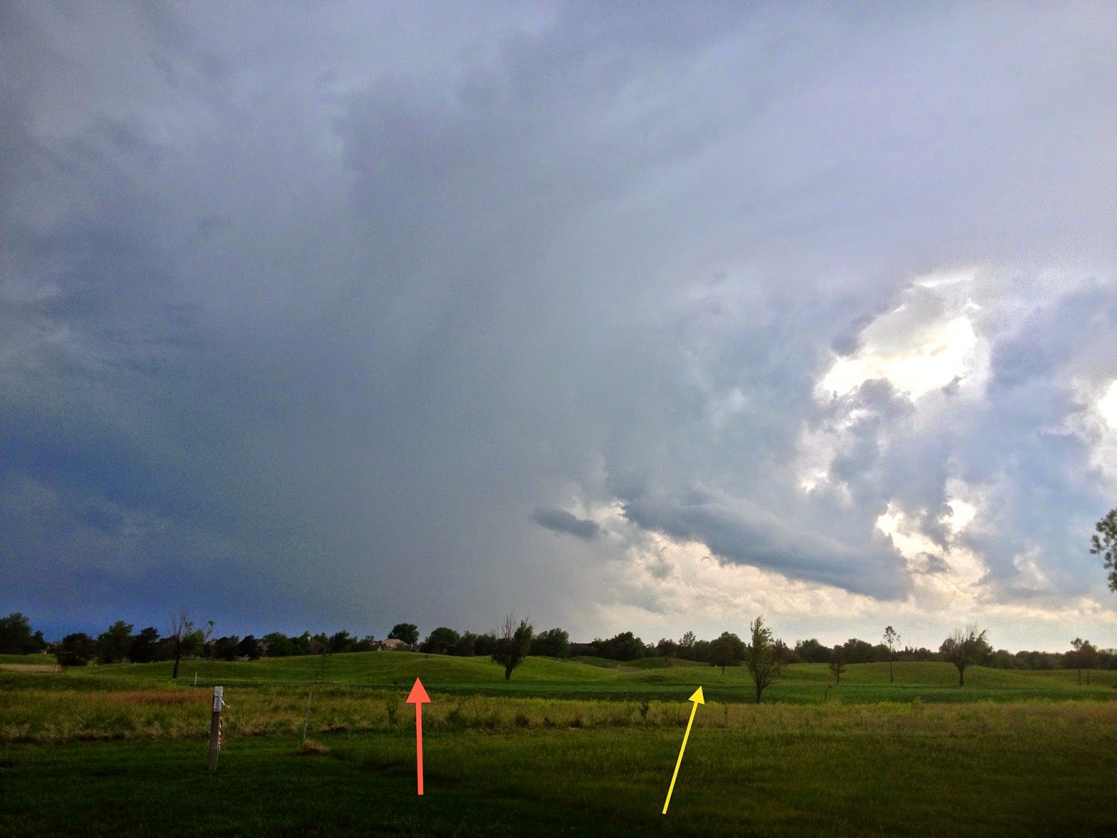
I turned the radar upside down so you could more readily compare the closer (yellow) and farther (orange) storms.
A New Cloud Formation?
I've never seen a cloud arch before.
From my location it appeared to be continuous cloud for the entire 180 degrees.
Today's Texas Tornado Watch
Note the potential for large hail is "high" and ≥2" is "moderate." Even if you don't get a tornado, the possibility of 60 mph or higher winds is moderate. Put your car in the garage, bring in trampolines and lawn furniture and other things that might blow around.
Twenty-Four Notes
Each Memorial Day Weekend Fox News Sunday features "Bugles Across America." It is a volunteer organization that makes up for the shortage of military buglers and attempts to insure that every military funeral has live Taps. You can learn more about them here.
God bless every member of the U.S. military, past and present, this Memorial Day weekend.
Saturday, May 24, 2014
Five Inches Over the Next Five Days
The generous rains are forecast to continue by the National Weather Service:
Here is an estimate of rainfall since the drought-easing system moved in.
The Size of the Radar Echo Doesn't Matter
Shower brought us 0.63 inches in less than 45 minutes.
Absolutely pouring at The Smith House.
The tiny, but strong, radar echo bringing the rain.
Today's Tornado and Hail Threat
This map shows the tornado potential with 5% the significant threshold.
This is the probability of 1" or larger hail. The hatched area is where hail 2" or larger may fall. Recommend putting your car in the garage if thunderstorms approach.
I will be doing periodic severe weather updates this holiday weekend.
Glorious Rain! Day 4 of Drought Improvement
![]() |
Click to enlarge and show caption. National Weather Service map |
The rains continue in the drought region. Here is the current AccuWeather Regional Radar:
And, here is the forecast additional rainfall for the next seven days:
![]() |
NWS |
Another Global Warming Myth: Increasing Drought
From Dr. Roger Pielke, Jr.'s blog,
This is a graph of the percentage of the world in drought since 1982. Note that it is not increasing as Big Climate contends.
And, in another week, the percentage will be lower due to the generous rains in the central United States.
![]() |
click to enlarge |
And, in another week, the percentage will be lower due to the generous rains in the central United States.
Friday, May 23, 2014
More on the National Weather Service's Storm Warning Fiasco
As many know, the NWS had a major disruption to its data flow during yesterday's tornado warnings from Denver to Dover. Andrew Freedman reports:
The memo says the data disruption was triggered by an upgrade to the weather data dissemination system itself, specifically a modification to a network firewall. The firewall was supposed to continue to allow data to pass through it, but "within minutes, engineers noticed that data were not traversing the firewall." The memo claims all warnings did reach the public despite the loss of the main automated delivery system, which is a questionable claim considering that many storm chasers, television meteorologists, online news sites and others in the weather community reported disruptions in crucial radar data and severe weather warnings on Thursday.
The outage, which the NWS now says lasted from 3:49 to 4:25 p.m. ET on Thursday (although the system was not declared fully operational until 4:37 p.m. ET), occurred as severe thunderstorms erupted from the Denver metro area eastward to the Mid-Atlantic. A tornado warning was issued at one point for downtown Denver, and one strong tornado touched down near Albany, New York. Another weaker twister struck in Delaware around the time of the outage.
All of the clients of AccuWeather Enterprise Solutions received 100% of their warnings, radar and other products -- we were completely unaffected.
Andrew goes on to report:
Curiously, the memo states that the NWS is still investigating only two things regarding this outage. The first is "the root cause of the firewall disruption," but the second is "instances of any external nwschat users who violated agreed-to Terms of Use." The nwschat system is used as an instant messaging system for different NWS offices to share breaking information on severe weather. Media outlets can subscribe to it as well as long as they agree to the terms-of-use; those terms forbid users from "releasing content to a broader audience that might be misinterpreted or cause confusion. This includes streaming of chats via the web or web-like services."
In other words, the agency is going after anyone who is outside the agency who may have released information about the outage that they learned via the NWS chat system.
I guess we taxpayers are not entitled to learn why NWS systems have failed -- twice -- during tornado situations the last 30 days. It appears that the NWS has learned nothing since the self-inflicted battering of its reputation during the Hurricane Sandy assessment. Those actions brought widespread derision to the agency. Here is one of the many examples.
In o
Drought Improvement Update, Day 3
Here is the actual rainfall for the last 7 days, most all of which has fallen in the last three.
And, here is the additional forecast rainfall for the next seven days:
While this will not break the drought, it will ease it in many areas.
And, here is the additional forecast rainfall for the next seven days:
While this will not break the drought, it will ease it in many areas.
Thursday, May 22, 2014
Stunning -- Stunning -- Stunning!
On Mother's Day, two supercell thunderstorms rolled through central Kansas. I rarely use the term awesome video but this is just that. You'll see at least two funnel clouds under the base of these rotating supercell thunderstorms. Put the video on full-screen mode, turn up the music and enjoy a bit of Kansas in spring.
The Climax, Kansas Supercells by Stephen Locke from Stephen Locke on Vimeo.
Drought Relief: Day 2
Here is the current AccuWeather Regional Radar:
And, here is the forecast rainfall for the seven days beginning at 7pm CDT this evening:
![]() |
NWS Forecast |
Yes, that is more than six inches of rain forecast near Archer City, Texas. Remember, this is in addition to the rains that have fallen since yesterday afternoon. Even with these heavy rains, I do not expect any widespread flooding problems because the drought is so severe.
Tornado Threat in the East and Around Denver
The two red polygons are tornado warnings, the rest severe thunderstorm warnings. Radar at 4:47pm. Many reports of large hail and hail damage.
Hail at Amsterdam, NY (via Twitter):
Meanwhile, it is gridlock at the Northeast airports along with low clouds/fog at San Francisco. The column at right is the average delay in minutes.
For the second day in a row Denver is under a tornado warning with a second at Red Feather Lakes (near the Wyoming border).
Subscribe to:
Posts (Atom)