Sunday, March 31, 2013
Another 5-Star Review
There is another reader review posted at Amazon.
This book makes you step back and really think about how the warning systems are supposed to work. Great book !
With tornado season predicted to begin in earnest during the next ten days, now is the time to learn the lessons contained in Sirens. It includes tornado safety rules for home, school, and office. To order a copy of the ebook (software version is sold out) for $2.99, click here.
Latest Rainfall Update
Rainfall for the 24 hours ending at 7am this morning across the winter wheat belt. Heavy rains fell in northeast Texas after this data collection period ended.
Rainfall for the last seven days ending at 7am:
Strong Thunderstorms: Northeast Texas
From the northeast suburbs of Dallas to the Red River, strong thunderstorms are moving southeast across northeast Texas. Some areas will receive large hail and damaging winds. Yellow polygons are severe thunderstorm warnings.
Easter Sunday Fun
Happy Easter, Everyone!!
Nothing like music to to put a smile on everyone's face. I was watching PBS's Kristin Chenoweth: The Dames of Broadway...All of 'em!!! while doing a blog post and saw her speak highly complimentary words about Music Theatre of Wichita (we aren't just known for airplanes and college basketball!). That screen capture is immediately below.
PBS |
Music Theatre of Wichita
And, I equally enjoyed listening to "We Kiss in a Shadow." Her voice, even then, was unmistakable. You knew she was going to be a major talent.
Music Theatre of Wichita
I had the opportunity to meet Kristin several years ago and I'm pleased to report that she is just as nice in person as she appears to be.
By the way, if you enjoy the performances of Bebe Neuwirth, Tommy Tunes, or Kelli O'Hara, they are all alumni of Music Theatre of Wichita.
And, they are now selling season ticket for MTW's 2013 season.
Saturday, March 30, 2013
0.1% Picked Wichita State For Final Four
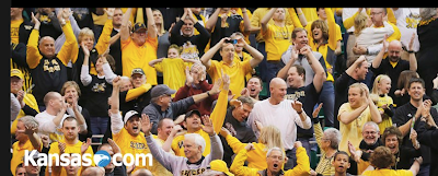
According to CBS, only one-tenth of one percent of the brackets had Wichita State making the Final Four. One of the reasons we have done so well is because we have been below everyone's radar. I don't know how others feel, but the TV coverage today was so biased in favor of Ohio State it was absurd at times. But that is OK with me. It works to our advantage.
The team was plagued by injuries this season and the five starters in the Tournament had not played much together much until the last couple of weeks. Those of us in Wichita knew that. But, because the national media tends to be pretty provincial, they simply did not realize how good this team is. On the other hand, I my daughter was in Vegas a week ago tonight (the night the Shockers played #1 ranked Gonzaga) and I asked her to put down a bet on WSU to win (not just cover the spread). I was that confident. My $50 turned into $120.
The referees tonight clearly made some pro-OSU calls (like not calling the flagrant foul on Carl Hall) but the team kept its composure and won.
I would not be surprised if they go all the way. Regardless, this is a team that reflects its coach: Great character, great professionalism, and great talent. Wichita is a terrific city (I am not a native) and the Shockers are terrific ambassadors. Too often in life, the good guys don't win. That is why this is so sweet.
Thank you for reading. Hope you'll join us in cheering on the Shockers Saturday.
"You're Gonna Know That We've Taken the World by Surprise!"
7:53pm Radar Update
Radar updated at 8:02pm
The Stronger Storms
As of 7:35pm.
I am not live-blogging the storms.
I am watching Wichita State up on Ohio State 41-25 with 15:23 in the game.
I am not live-blogging the storms.
I am watching Wichita State up on Ohio State 41-25 with 15:23 in the game.
Probability of ≥2" Hail is "High"
I'm not a fan on trying to chisel counties in and out of watches (as was done with McClain and Cleveland Co. on the north side of the watch. I think people in Norman and Blanchard should consider themselves to have a threat of large hail and damaging winds until 1am when the watch is scheduled to expire.
Thunderstorms could later develop near the Red River and the Metroplex.
Quick Radar Tour (at Halftime)
With the Shox up 35-22 at the half, let's take a quick radar tour with 7:15pm radar images:
Ozarks
Large hail may move into both Joplin and Branson-Table Rock Lake during the next two hours.
Oklahoma
Thunderstorm with heavy rain in northern Tulsa County moving ESE. Thunderstorms with hail from Seminole to Okemah moving southeast.
ADDITION: 7:22pm. Large hail developing west of Owasso. Will movesoutheast. east toward Valley Park then toward Justice if it holds together that long.
Ozarks
Large hail may move into both Joplin and Branson-Table Rock Lake during the next two hours.
Oklahoma
Thunderstorm with heavy rain in northern Tulsa County moving ESE. Thunderstorms with hail from Seminole to Okemah moving southeast.
ADDITION: 7:22pm. Large hail developing west of Owasso. Will move
Much-Needed Rain the Next Seven Days
I not only agree with this map, I believe that moderate to heavy rains are possible in the central and southern Plains along with the Midwest from day 8 (April 7) to about day 13. If the weather pattern develops as I expect, I would not be surprised if isolated spots in the central and/or southern Plains received as much as five inches of rain. Given the lingering drought, the moisture would be very beneficial.
Shockers Versus Ohio State
Update 7:07pm
At the Half....
Wichita State 35
Ohio State 22
UPDATE: 3:30PM, just arrived at east Wichita sports bar for game. It is nearly full.
There is already a wait list for larger tables!
WuShock is telling everyone to cheer for Wichita State against Ohio State in tonight's Elite Eight game. It is on CBS at 6:05pm CDT.
The fan shops around town are absolutely packed and cars all over town have WSU flags flying. Win or lose, this is great fun. Gregg Marshall and his team are wonderful representatives of a wonderful city.
Severe Thunderstorm Watch Until 10pm
UPDATE: 4:41PM. Large hail making its way southeast across southeast Kansas.
Large hail approaching Girard, Arma, Mulberry and (crossing the state line)
Liberal, MO.
original posting:
A second severe thunderstorm watch, also until 10pm.
The radar at 2:13pm shows intensifying thunderstorms in east central Kansas and will start moving southeast.
I'm not live-blogging storms today.
Probably Wouldn't Hurt to Put the Car in the Garage
UPDATE 12:10PM
The NWS Storm Prediction Center has updated the forecast. The hatched area is where hail of more than two inches in diameter is forecast.
Original Posting:
Probability of 1" or larger hail between about noon today and 7am Easter Sunday morning.
Rainfall the Last Two Days
The Media Finally Catches On -- But Not in the U.S.
If climate scientists were credit-rating agencies,
climate sensitivity would be on negative watch.
-- "The Economist"
![]() |
click to enlarge |
The widely respected The Economist, which has been frustratingly shrill on the topic of global warming, more or less prints a retraction. That story is here.
Friday, March 29, 2013
Wind Turbines Cluttering Up the Great Plains
Tornado Warning near Fictional "Cousin Eddie"
Red is the tornado warning for Hamilton Co., Kansas. The tornado near Coolidge, KS which is where the fictional character of "Cousin Eddie" in National Lampoon's Vacation hailed.
Yellow polygons = severe thunderstorm warning.
Key an Eye Out Canadian County, OK
Radar at 6:49pm.
The storm just northeast of El Reno is showing a little rotation as it moves southeast. Keep an eye on it, if you live in eastern Canadian Co. Large hail is falling from this storm, as well.
The more northern storm may produced large hail.
UPDATE: 6:48PM, 2" hail at Richland, OK.
The storm just northeast of El Reno is showing a little rotation as it moves southeast. Keep an eye on it, if you live in eastern Canadian Co. Large hail is falling from this storm, as well.
The more northern storm may produced large hail.
UPDATE: 6:48PM, 2" hail at Richland, OK.
1 Tornado; Multiple Severe Thunderstorm Warnings
6:28pm, tornado warning in red polygon, large hail in yellow polygon. Blue line is I-80.
ORIGINAL POSTING:
As of 6:05pm CDT, tornado warning with red arrow'd storm, large hail with the yellow arrow'd storms.
Just got reports (6:02 and 6:15pm of the tornado near North Platte, NE moving east. )
Large hail possible in northwest parts of the OKC area at 6:15pm.
ORIGINAL POSTING:
As of 6:05pm CDT, tornado warning with red arrow'd storm, large hail with the yellow arrow'd storms.
Just got reports (6:02 and 6:15pm of the tornado near North Platte, NE moving east. )
Large hail possible in northwest parts of the OKC area at 6:15pm.
Severe Thunderstorm Threat Texas and Oklahoma
While we don't usually cover severe thunderstorm watches, I wanted to get this out since the probability of hail one inch in diameter or larger is "high" and the probability of 58 mph wind gusts or higher is "moderate." The severe thunderstorm watch is in effect until 11pm.
Below is the radar as of 4:48pm with a strong thunderstorm northeast of Lubbock and southwest f Abilene.
I will not be live-blogging the storms.
Below is the radar as of 4:48pm with a strong thunderstorm northeast of Lubbock and southwest f Abilene.
I will not be live-blogging the storms.
Rainfall Maps
![]() |
This morning's Missouri map. Click to enlarge. |
Thursday, March 28, 2013
Go Shockers!!
This post will stay at the top of the blog throughout the day. Scroll down to meet the Shox latest fan! New postings below this:
WSU's Sweet 16 game is this evening at 9:17pm Central.
For the story of WuShock, click here.
Of course, the goal here in Kansas is for both of our teams to keep winning and meet in the national championship game.
![]() |
KAKE TV |
In addition to all he did for the town of Greensburg after their 2007 tornado, look who is wearing a Wichita State cap!!
![]() |
Wichita State University via Facebook And, another fan! (photo from Brett Harris) |
More on Why the "Impacts Based Warnings" Experiment is a Bad Idea
Based on several weather discussion groups and tweets, my opinion of the National Weather Service's impact-based warnings experiment is not going over well with some. Fair enough. At least two have written that (paraphrasing) I should chill out because "it is just an experiment." [emphasis mine] That is sort of true. But, I object to the public being used as guinea pigs when the stakes are so high.
This experiment could cost lives. That is why I am so opposed.
For the moment, let's disregard the fact that incorrectly warning people that "mass devastation" is about to occur -- with the storm then completely missing the warned area -- might cause people to disregard future warnings. That would be an indirect effect of this experiment.
It is entirely possible this experiment may cause a direct loss of life. Some weather scientists tell people in mobile homes and in other areas without shelters to get in their car and drive away from the tornado's path:
On April 14, 2012, the Wichita National Weather Service office told the people of Conway Springs, Kansas, "Debris will block most roadways. Mass devastation is highly likely making the area unrecognizable to survivors." Suppose you live in a mobile home or a house without a basement, you have heard the advice to "flee mobile homes" during tornado warnings, and you get that "tornado emergency" -- mass destruction is "highly likely" wording? So, you get in your car and flee Conway Springs.
As you can see from the map, nothing happened in Conway Springs. But, if you had decided to follow the advice of meteorologists to "flee" you could have been killed by driving into one of the tornadoes that missed the town. By trying to scare ("mass devastation," "survivors," and similar language) people into taking shelter they might be induced to take action that costs them their lives.
While weather science can do a good job of warning of a tornadoes, forecasts of movement and location are not accurate to the quarter mile nor do we have any skill at forecasting the mile-by-mile intensity of the storm. This is the crux of my objections.
I invite scientists who believe my facts are wrong to post comments.
This experiment could cost lives. That is why I am so opposed.
For the moment, let's disregard the fact that incorrectly warning people that "mass devastation" is about to occur -- with the storm then completely missing the warned area -- might cause people to disregard future warnings. That would be an indirect effect of this experiment.
It is entirely possible this experiment may cause a direct loss of life. Some weather scientists tell people in mobile homes and in other areas without shelters to get in their car and drive away from the tornado's path:
On April 14, 2012, the Wichita National Weather Service office told the people of Conway Springs, Kansas, "Debris will block most roadways. Mass devastation is highly likely making the area unrecognizable to survivors." Suppose you live in a mobile home or a house without a basement, you have heard the advice to "flee mobile homes" during tornado warnings, and you get that "tornado emergency" -- mass destruction is "highly likely" wording? So, you get in your car and flee Conway Springs.
![]() |
Map of April 14 tornadoes (from Wichita NWS) west, south and east of Conway Springs |
While weather science can do a good job of warning of a tornadoes, forecasts of movement and location are not accurate to the quarter mile nor do we have any skill at forecasting the mile-by-mile intensity of the storm. This is the crux of my objections.
I invite scientists who believe my facts are wrong to post comments.
Subscribe to:
Posts (Atom)