Saturday, June 30, 2018
Friday, June 29, 2018
"I Truly Admire Kansans"
![]() |
From Amanda's Tweet. |
Amanda also included the photo below as a volunteer tarped a roof.
Some additional thoughts: Last Friday, I met a woman in her early 20's who moved to Wichita five months ago from Calabasas, California. I asked her, "How do you like it?" She replied that she was surprised she "loves it." She moved here because of a family emergency but now thinks she will stay. She did add we "need a Nordstroms."
Just yesterday, I am aware of Kansans who drove 180 miles to take baby supplies from Wichita to Kansas City to handle a charity emergency. No charge, not even mileage.
This morning, the Wichita Business Journal reported we need more workers in the city. If you are looking to move yourself or your family, please consider us. It is a special place.
Meteorology: Isn't Technology Wonderful??
Yesterday evening, I watched the entire lifecycle of a tornado on Roger Hill's video stream. Above are videos from yesterday evening from my friends at Live Storms Media.
I wouldn't give you a nickel for Facebook (have discontinued my membership due to their shady business practices which may be getting worse), Instagram, Snapchat, etc., etc. That said, the ability to transmit live images of tornadoes and other storms improves the warning process and has the added value of helping convince people to take shelter.
Now if we can just get the CAM models to work in the summer......
Thursday, June 28, 2018
Some Thoughts About the Eureka Tornado Recovery
![]() |
Via Foxnews.com |
- This was a very serious tornado. The local government turned on the sirens before the tornado hit and so injuries were less than I would have guessed. This is one of those cases against having sirens (as some have proposed) exclusively under the control of the National Weather Service.
- For some reason, there are many in the meteorological community that don't like sirens. Sirens certainly have a role. They can be activated instantly and, in the Great Plains, everyone knows what they mean. Note: I am saying they have a role. They should never be used as the sole source of warning information.
- "Church groups" often get maligned in the national MSM. Yet they have poured in to work, under the direction of local emergency management, regardless of a predicted high temperature of 100° and a forecast heat index of 110°. In addition, there is not a cloud in the sky and the sun is beating down. This is called "loving thy neighbor."
- By all accounts, the (genuine) Wichita Linemen (as well as from other cities) from Westar Energy are doing an amazing job under extremely difficult circumstances.
- And, while I have watched all three stations' coverage, what don't we see? FEMA. And, given FEMA's historic propensity for publicity, I'm sure we would know if they were there.
Kansans are hardy people. That said, the people of Eureka, Kansas, could use your prayers. So far, the charities I trust are not asking for special donations. 2018 has been a much below normal year for tornadoes so I'm guessing they have adequate resources.
How Frequent Are Tornado and Severe Thunderstorm Watches?
Below are maps that depict, county-by-county, the frequency of tornado and severe thunderstorm watches. Click to enlarge.
The county most often under a severe thunderstorm (≥1" hail and/or ≥60 mph winds) Marion County, Kansas. Note the interesting "island" of high frequency of severe thunderstorm watches around Washington, DC. Its frequency of severe thunderstorm watches is higher than parts of Kansas and Oklahoma. I wonder if that is partly political -- the desire not to "miss one" a storm forecast for the nation's capital?
To a meteorologist, there is nothing surprising about tornado watches. To the general public, it might be surprising that the Deep South, especially in recent decades, has had the highest frequency of tornadoes. The county most often under a tornado watch are Lincoln and Lawrence counties of Mississippi.
Wednesday, June 27, 2018
The Truth of The (Non-) Warning of the Eureka, Kansas, Tornado
I was disappointed shortly after 5pm this evening when I watched KAKE TV, a Wichita TV station, host a National Weather Service meteorologist who told the people of Eureka, Kansas, and his wider audience, several things that were inaccurate when it came to the reason they did not issue a tornado warning before the EF-3 (strong!) tornado struck.
The Background
This was a poor performance by the NWS considering it was an EF-3 tornado. There no tornado warning. There was neither a tornado watch nor a severe thunderstorm watch. I am going to focus on the lack of a warning.
Points made during the KAKE interview along with my rebuttal:
KAKE TV, damage in Eureka |
This was a poor performance by the NWS considering it was an EF-3 tornado. There no tornado warning. There was neither a tornado watch nor a severe thunderstorm watch. I am going to focus on the lack of a warning.
Points made during the KAKE interview along with my rebuttal:
- "The radar operates at five minute intervals, so we couldn't see the tornado spin-up." The radar has the ability to operate in the "SAILS" mode which will allow them to view the storms has 1.2 minute intervals -- four times more frequently.
- "The spin-up couldn't be anticipated." There had already been a tornado in Butler County, the county immediately to the west. The Significant Tornado Parameter was "2", above the threshold of one (see below). Both should have alerted them to the danger.
My conclusion: A warning should have been issued before 7:15.
Below is the data so those who are familiar with these situations can make up their own minds.
Significant Tornado Parameter Available One Hour Before the Tornado Touched Down
The storm in question is within the red "2" value.
The Earlier Tornado to the West
This was a statement issued by the National Weather Service in Wichita 38 minutes before the Eureka tornado.
The Doppler Radar Data
I am not annotating the data because I don't want to cover up the data with the annotations. Click to enlarge. The Doppler wind data is on the right and the (developing) tornado is where the greens and reds come together.
![]() |
7:01pm. Rotation clearly developing along US 54 west of town. |
![]() |
Skipped an image to save space. The rotation is tightening west of the city. There is clear rotation seven minutes before the tornado touches down. |
![]() |
Clear indication of a developing tornado. |
![]() |
Tornado on the ground in east Eureka. The yellow/green is the tornado. |
![]() |
Tornado northeast of the city. Second area of rotation over Eureka. |
I believe that any trained, experienced meteorologist would come to the same conclusion: a tornado warning would have been possible prior to the tornado touching down.
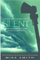
In addition, during the KAKE-TV interview, it was said by one of their meteorologists that the Joplin Tornado spun-up in a couple of minutes. Incorrect! I cover that in my book, When the Sirens Were Silent.
Hopefully, we can learn from this event so it does not happen in the future.
Tuesday, June 26, 2018
This Evening at the Smith House II
As the sun goes below the horizon, it illuminates the mammatus from below. The light bending causes the orange glow. This was at 8:45pm.
And, looking the other direction at a thunderstorm approaching our home.
From the Smith House This Evening
It has been a very stormy day in Kansas.
This was at 8:25pm CDT. It depicts cumulonimbus mammatus clouds along with towering cumulus clouds in the foreground.
Significant tornado damage in Eureka, Kansas. Large hail in many areas of central and southeast Kansas.
This was at 8:25pm CDT. It depicts cumulonimbus mammatus clouds along with towering cumulus clouds in the foreground.
Significant tornado damage in Eureka, Kansas. Large hail in many areas of central and southeast Kansas.
One of the Most Dramatic Tornado Videos I've Ever Seen
While you do not see the funnel well, this is an amazing tornado video. It illustrates well why you need to be in shelter when a tornado threatens. Just yesterday, a Boy Scout was killed when a tree fell on his tent.
Monday, June 25, 2018
Drought Dented
The heavy rains in the last two weeks have significantly dented the drought that began last autumn in the Great Plains.
Rainfall Ending at 7am CDT This Morning
Rainfall For the Last Two Weeks
You can click to enlarge both graphics and note they have different color scales.
Rainfall Ending at 7am CDT This Morning
Rainfall For the Last Two Weeks
You can click to enlarge both graphics and note they have different color scales.
Saturday, June 23, 2018
Saturday Tribute: Bob Dole's Final Mission
An incredibly touching article from The Washington Post about Kansas' Bob Dole and him greeting the Honor Flight veterans at the World War II Memorial.
After you have read the article: Some of us (I've had the pleasure of meeting and talking with our former senator on several occasions) have known the struggle Bob has had to dress himself daily. Can you imagine a half-hour just to put on a shirt and slacks with a nurse assisting? Bob used to insist on dressing himself in a suit and tie daily and I understood it took more than an hour. He had to use a button hook.
Regardless of your politics, Mr. Dole is a profile in courage.
Thank you, Washington Post.
Friday, June 22, 2018
Report on Dr. Jordan Peterson's Indianapolis Appearance
I am a big fan of Dr. Jordan Peterson. I highly recommend watching one of his interviews or appearances before you make up your mind about him, rather than reading what some in the media say about him.
His famous interview with Cathy Newman is here.
However, if you are going to read about his philosophy and appearances, this detailed report from Indianapolis -- and, how Dr. Peterson may have saved the life of an audience member -- is the one to read.
His famous interview with Cathy Newman is here.
However, if you are going to read about his philosophy and appearances, this detailed report from Indianapolis -- and, how Dr. Peterson may have saved the life of an audience member -- is the one to read.
Thursday, June 21, 2018
It Was 30 Years Ago Today...
...the global warming war began. Almost none of the predictions (other than atmospheric temperatures would rise...not accounting for the "pause" that began in 1999) made that day came true. We have spent more than a half TRILLION dollars on this mild problem. Think of the numerous better uses for that money!
There is a wonderful essay commemorating this sad anniversary here.
Wednesday, June 20, 2018
Some Thoughts Pertaining to Smart Phones and Tornado Warnings
Conventional wisdom in meteorology says that brief tornadoes that spin up with "mesolows" cannot be warned of because "the tornado will be gone before we can get the warning out."
I have disagreed. In the era of smart phones and immediate television notifications (crawls), there is time. They display a warning instantly.
An example is yesterday in far northwest Kansas.
The "19hr" is because I retrieved this a few minutes ago.
Please note that in this case, the Goodland NWS did a great job and had a tornado warning out in time to notify people in danger. But, that is the exception rather than the rule.
Even though I had to add the state abbreviations and note the location of the developing tornado and extreme winds, the notification was on Twitter and was available before the tornado and damaging winds occurred:
As indicated by my circles, the strongest radar-indicated winds went south of St. Francis so I imagine the peak gusts were indeed around 90 mph. That area is very sparsely populated, so the lack of confirmation does not surprise me.
The National Weather Service should put better warning software in place so warnings can be issued more quickly and, as a whole, should rethink tornado warnings in these situations. Had this been in a densely populated area, there would have been considerable mild to moderate damage.
----
Addition: Here is a view of the extreme winds.
Excellent, Easy-To-Read Article On Climate Models
I'm sure the entire topic of climate models seems intimidating to the layman. Here is an easy-to-read article that also brings us good news -- the models that have been used have overstated the amount of global warming.
Tuesday, June 19, 2018
Another Data-Free Global Warming Study
I am sorry to see the Wall Street Journal fall for this. The study in question did not look at actual precipitation amounts to verify what the computer simulation said. From the actual data I am able to gather, the computer study is incorrect. The Great Plains climate is not shifting to drier conditions.
Monday, June 18, 2018
The Practical Use of Aviation Research
Saturday, I discussed the critical research being done by Kansas State University to develop wheat that is more tolerant of warmer nighttime temperatures (please scroll down). Today, I would like to point you to important work being done by Wichita State University.
Yes, there are serious problems with the F-35B aircraft. And, the solutions may be found a few miles from my home at the National Institute for Aviation Research which is run by Wichita Sate University (WSU) The article is fascinating and you will find it here.
Many who are not familiar with Wichita are surprised to learn it is the aviation capital of the world -- more planes are made here than in any other. And, in order for those planes to be state-of-the-art, WSU is one of the leading universities in the world in the field of aviation research.
Sunday, June 17, 2018
If Dad Received A Nook or Kindle...
I'd like to modestly suggest my book about the Joplin Tornado.
"Mr. Smith's timeline and reporting of the warnings received is spot-on. The book is a short read but it makes his points clearly understandable. My son and I are alive because of my own gut instinct that came from living in Joplin since I was nine. Neither the Joplin emergency management nor the NWS played any role.
"Whew, I just read it. Heart racing!!"
"Great work! Its informative and entertaining. I was anxious while reading it and I had to continue to remind myself that I already knew the outcome."
Being a storm spotter in SW Missouri, this book is incredible.
If you want to see what it is like to be in a violent tornado, When the Sirens Were Silent is a great ebook for Nook, Kindle or the free Amazon online reader (you can read it on your computer without a separate device). Check it out.
What do four people who experienced the Joplin tornado have to say about
When the Sirens Were Silent?
"Mr. Smith's timeline and reporting of the warnings received is spot-on. The book is a short read but it makes his points clearly understandable. My son and I are alive because of my own gut instinct that came from living in Joplin since I was nine. Neither the Joplin emergency management nor the NWS played any role.
"Whew, I just read it. Heart racing!!"
"Great work! Its informative and entertaining. I was anxious while reading it and I had to continue to remind myself that I already knew the outcome."
Being a storm spotter in SW Missouri, this book is incredible.
If you want to see what it is like to be in a violent tornado, When the Sirens Were Silent is a great ebook for Nook, Kindle or the free Amazon online reader (you can read it on your computer without a separate device). Check it out.
Father's Day Sunday Fun: Tracking a Train and Storms on Radar
Happy Father's Day!!
Lots of Dads like trains and many meteorologists like trains. So, I have been saving this since June 6. While I have tracked trains on weather radars before, this is the first time I have seen a train on the same radar images as severe thunderstorms.
The Union Pacific train was traveling southeast across south central Nebraska. The train is highlighted at the bottom.
![]() |
click to enlarge |
In this case, I do not know what type of train it was but I suspect it was a double stack or autorack.
Saturday, June 16, 2018
Dangerous New Disease Emerging in China
Whether it is this disease (full article here) or some other, it is highly likely there will be a global pandemic in the next few decades. There is good reason to believe the U.S. and other nations are not as well prepared as we should be. With election season coming up, this is probably a good question to ask your local politicians.
How The U.S. Grows More Food at Less Cost
We've discussed a number of times how the forecasts of doom (perpetual famines that would starve millions) made in the late 1960's and 1970's were completely wrong. What doomed the forecasts of doom were two things: warmer global temperatures and the Green Revolution. The latter was primarily due to the insights and research of the late Norman Borlaug.
![]() |
Kansas State University Research and Extension |
In the United States, many of us take our food for granted. It seems to magically appear at the grocery store. But, if we are to continue to provide nutritious food for ourselves and for a growing world, we must continue to research better ways of growing and producing crops. Most of this work is done by Kansas State University (KSU) and other land-grant colleges.
Science360 has a brief article about some of that research being done at KSU. I cite this article because it centers around developing wheat that is more tolerant to higher nighttime temperatures.
While the Al Gore hypothesis of accelerating and catastrophic global warming has been falsified, the climate has changed. The most important aspect of that change is warmer nighttime temperatures. The warmer nighttime temperatures in spring mean longer growing seasons (good!). But, they can severely stress a crop during the heat of summer (bad!).
This research is hard work and, as the article indicates, most of the work is done at night. These unsung food research heroes are responsible for our food prosperity and deserve credit for the hard work they do.
Friday, June 15, 2018
Octopi and Starfish Fall From the Sky
Really.
A waterspout (tornado over water) moved inland in China and dropped octopi, starfish and other sea creatures on land. The full story is here.
There have been reports of similar occurrences in the past.
Note: I have met a number of officials of the China Meteorological Agency and if they have confirmed this, then I believe it.
![]() |
Photo of octopus attached to window of building |
There have been reports of similar occurrences in the past.
Note: I have met a number of officials of the China Meteorological Agency and if they have confirmed this, then I believe it.
Thursday, June 14, 2018
Climate 'Science' Veers Into Utter Silliness Again
As the horror stories of sudden, accelerated global warming have convincingly been proven to be false, Big Climate ($35,000,000,000 per year spent by the U.S. alone) must be getting nervous. Otherwise, I can't think of a good reason for a paper to be published that claims that even if temperatures do not go up as much as they were forecast to rise,
This means that even if a low temperature response [to CO2] helps us to meet the temperature target, there may still be ‘dangerous’ changes in [temperature and weather] extremes
(hat tip, Anthony Watts). "Low temperature response" means what people like me have been saying: the atmosphere does not warm as fast as the alarmists say.
Apparently, CO2 (the fizz in your pop) is some sort of magic gas that can create tropical storms and extreme summer temperatures out of nothing. Of course, this rather remarkable contention comes to us courtesy of
Researchers from Oxford and other institutions participating in the HAPPI-MIP project (Half a degree Additional warming, Prognosis and Projected Impacts Model Intercomparison Project) ...
Sigh, yet another computer model simulation. You know the same ones that completely missed the 15-year "pause" in global warming and have missed the current cooling in global temperatures? But, at least this model is HAPPI (good grief!).
This paper smacks of desperation by Big Climate. Now that their 30-years (as of next month) of contentions and "tipping points" that disastrous weather/climate is always just over the horizon, they are trying to find something else to keep the gravy train rolling down the track. It is past time to cut U.S. climate research back to a more reasonable level.
For those of you who want a scientific discussion of this subject:
Carbon dioxide concentrations have risen considerably since the 1950's (when they were first systematically measured worldwide).
However, there is no trend whatsoever that people are dying in greater numbers as result.
#2. According to the paper in question, more CO2 means more tropical storms. You can see the increase in CO2 (red curve above) has increased since 1970 but there is no increase in tropical storms or hurricanes.
#3. Five years ago, we had these types of stories about global warming causing worsening storms routinely. The stories pertained to both tornadoes and hurricanes. We have had record or near record low numbers of tornadoes the last few years, counter to what was predicted in 2013. When you go to the NOAA page pertaining to yearly numbers of tornadoes (which would verify that contention), this is what you get...
Oxford and the others could have figured all of this out by looking at genuine data (as I have here) instead of a "simulation" of the future. Of course, that would have falsified their research and would have further jeopardized the gravy train.
This means that even if a low temperature response [to CO2] helps us to meet the temperature target, there may still be ‘dangerous’ changes in [temperature and weather] extremes
(hat tip, Anthony Watts). "Low temperature response" means what people like me have been saying: the atmosphere does not warm as fast as the alarmists say.
Apparently, CO2 (the fizz in your pop) is some sort of magic gas that can create tropical storms and extreme summer temperatures out of nothing. Of course, this rather remarkable contention comes to us courtesy of
Researchers from Oxford and other institutions participating in the HAPPI-MIP project (Half a degree Additional warming, Prognosis and Projected Impacts Model Intercomparison Project) ...
Sigh, yet another computer model simulation. You know the same ones that completely missed the 15-year "pause" in global warming and have missed the current cooling in global temperatures? But, at least this model is HAPPI (good grief!).
This paper smacks of desperation by Big Climate. Now that their 30-years (as of next month) of contentions and "tipping points" that disastrous weather/climate is always just over the horizon, they are trying to find something else to keep the gravy train rolling down the track. It is past time to cut U.S. climate research back to a more reasonable level.
For those of you who want a scientific discussion of this subject:
Carbon dioxide concentrations have risen considerably since the 1950's (when they were first systematically measured worldwide).
![]() |
NOAA Mauna Loa Laboratory CO2 Measurement |
#1. The medical evidence shows more than twelve times as many people die from cold as from heat. Warmer temperatures = fewer total deaths.
#2. According to the paper in question, more CO2 means more tropical storms. You can see the increase in CO2 (red curve above) has increased since 1970 but there is no increase in tropical storms or hurricanes.
![]() |
Dr. Ryan Maue |
Oxford and the others could have figured all of this out by looking at genuine data (as I have here) instead of a "simulation" of the future. Of course, that would have falsified their research and would have further jeopardized the gravy train.
Wednesday, June 13, 2018
Tuesday, June 12, 2018
I Really Like This Cartoon...
...so, I am sharing it with you.
I prefer say "free enterprise" than "capitalism" which is what it actually is. If people are passionate about creating and running a business (restaurant, copper mine, airline, it doesn't matter) they will manage it better than "experts" appointed by the government. That passion and expertise makes for an entrepreneurial class that will make people and a nation grow and prosper.
Monday, June 11, 2018
Review of "Warnings" By Gary England
Gary England is Oklahoma's legendary meteorologist. When he retired in 2013, the New York Times ran a feature-length article about him and his career (headline above). He has saved countless lives with his storm warnings and pioneering technology for reporting on storms.
That is why I am so pleased to report that he recently read Warnings: The True Story of How Science Tamed the Weather and his review is below.
A review ofWarnings by Mike Smith
A splendid book. The author takes you through great presentations of real life major emergencies, from tornadoes and hurricanes to the rise of meteorology. Mr. Smith allows you to join the events to the point where you actually become a part of history as he was.
As a highly acclaimed well-known meteorologist and scientist, Smith softly and intricately weaves in the science of storms and the necessary growth of meteorology into an easily readable and exciting adventure.
One of many highlights is his personal involvement with the Delta 191 crash at Dallas, which was brought down by a microburst. He takes you from the crash, the crash's causes, and the following court battle.
I must say, I highly recommend this book. It is a diamond!
Gary A England
Consulting Meteorologist in Residence at the University of Oklahoma
Doctor of Humane Letters-OU
B.S. in Mathematics and Meteorology
Thank you very much, Gary!
"Let There Be Light"
So much for gradual evolution.
Please note, there is no question that evolution occurs within species. But, the "war on creation" has taken an interesting turn.
Sunday, June 10, 2018
Major Break in the Drought From an Unlikely Source
Hurricane Bud in the Pacific is currently moving northwest and intensifying.
If the computer models are correct, by Friday night moisture from the hurricane will be streaming into the Southwest, the Rockies and the central and northern Great Plains (arrows).
Ten-day rainfall amount forecasts are very generous. The ECMWF model's forecast:
The GFS model's forecast:
Given the severe drought in many areas, this rain would be a tremendous help.
60th Anniversary of the First Tornado Measured by Doppler Radar
Today is the 60th anniversary of the El Dorado, Kansas, Tornado. It killed 13 and caused severe damage across the city.
In 2011, the city erected a beautiful memorial to the victims.
The tornado marked an important milestone in the history of weather science: it was the first time a tornado was detected by Doppler radar. The Weather Bureau had put experimental Doppler
radars in Wichita and Wichita Falls in 1958 and 1959. The El Dorado Tornado was the only one successfully measured; it had winds of more than 200 mph.
While the hypothesis that tornadoes could be successfully detected as they occurred by Doppler radar was confirmed, it would take another 34 years before operational Dopplers began to be installed across the United States.
Saturday, June 9, 2018
Another Happy Reader of "Warnings"!!
This was posted on Twitter this morning. Warnings makes a great gift, especially for Father's Day or to take on your summer vacation. Click here for more reviews and information about this great book.
And, if you give Dad a copy of Warnings or any book, please write something to him on the blank page inside the cover. A book is treasured forever and a personalized inscription will make it even more special!
Subscribe to:
Posts (Atom)