Super Bowl 55 tickets must not be selling well in the pandemic.
I came to that conclusion because the Chiefs sent me an email offering tickets. Even though I am a tremendous Chiefs fan, I stopped going to Arrowhead Stadium a decade ago because of the hassles (airline-style searches, absurd parking, high prices, drunks) and because the game can be seen better on HD TV.
For fun, I decided to see what tickets cost when purchased from the NFL.
$16,576 per ticket!?Sure, I'll just see if Climate Czar John Kerry will buzz over and pick me up on his private jet. Once we get there, I'll buy the popcorn.
I'll be watching on TV, thank you. And, Go Chiefs!!
Here is the correct 7-day precipitation forecast for the Mid-Mississippi Valley.
I thought the earlier forecast was "extraordinary" (which is why I labeled it that way). I checked, twice, to make sure it was the forecast for the correct time period and, with at least two major storms in the offing, the forecast was possible. Over the last few months, on far too many occasions, the NWS has released old or incorrect forecasts.
The earlier forecast is below.
I have not hit this too hard because I have been hoping President Biden would nominate a person to fix the National Weather Service's serious issues in the near future. That, at least right now, does not appear to be in the offing. So, I'll say it now.
The National Weather Service is comprised of an outstanding workforce that accounts for it being able to issue lifesaving tornado warnings like the one for Birmingham earlier this week.
That said, the NWS organizationally is falling apart. It it failing in some of its most basic mission activities such as launching weather balloons, gathering upper air data (the vital Profiler network that was allowed to wither and die), plan a new radar network, etc., etc. Its new radar and other web sites have serious issues. And, when Congress has tried to step in and help, its nonsensical response was bad radar data doesn't matter in warning accuracy.
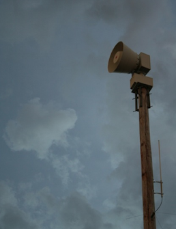
In the confusion about the tornado warnings in parts of the Birmingham metro area Monday night, I learned that their sirens sound only in the area threatened by the tornado. That is now true in Wichita, Ft. Worth and many other cities. Selective siren activation will only grow in the coming years as opposed to the old countywide siren activations.
As we roll into tornado season 2021, make sure you know how your sirens are activated. If they do not go off in an area not threatened, that is a good thing -- fewer false alarms.
Due to Monday evening's tornado in Birmingham and from a presentation I made last week, the questions are flowing,
Is climate change causing more violent tornadoes?
It turns out the reverse is true. Violent tornadoes are much less common than they were 50-70 years ago. The chart below is updated through 2020.
The dashed orange line shows the downward trend of violent tornadoes (F-4 or EF-4 or stronger on the Fujita Scale) since the 1950's. In 2018, we didn't have a single violent tornado anywhere in the United States.
This is one of the benefits of a warmer climate. However, fewer tornadoes and the other benefits do not outweigh the wisdom of decarbonizing our energy supply.
Update: Mr. Bender has apologized for his "assumptions." You can read it here. But, everything written below is (unfortunately) correct. Lazy reporting.
Here we go again, this time it is Southern Living with inaccurate, lazy reporting about storms.
"There-Was-No-Warning."
Except there was. Seven minutes' worth. Sirens going off. Weather radios going off. WEA activated smartphones and weather apps going off. You can see for yourself in the video below.
This Isn't Funny
Yesterday, we talked about the NBC Today Show getting this topic wrong. Now it is Southern Living. Every journalist in the U.S. seems to have a "function" key set up for the phrase, "there was no warning" on their laptop which they depress after every damaging tornado without even doing rudimentary research to learn if it is true.
We meteorologists have enough of a challenge getting everyone to shelter during dangerous tornadoes without the mainstream media inaccurately telling everyone "there was no warning" even when the warning was excellent as it was Monday night.
The author is a Southern Living contributor named Steve Bender, a/k/a the "Grumpy Gardner." I did some checking and he says he lives in Birmingham. I have a hypothesis: if he wasn't in the path of the tornado the warning system did not activate for his location. So, if I am correct, he lazily assumed it didn't activate anywhere. We don't want to activate the warning system outside of the areas directly threatened. Otherwise, it creates false alarms that kill credibility.
The media in the United States is a disgrace. I wish I knew how to fix it.
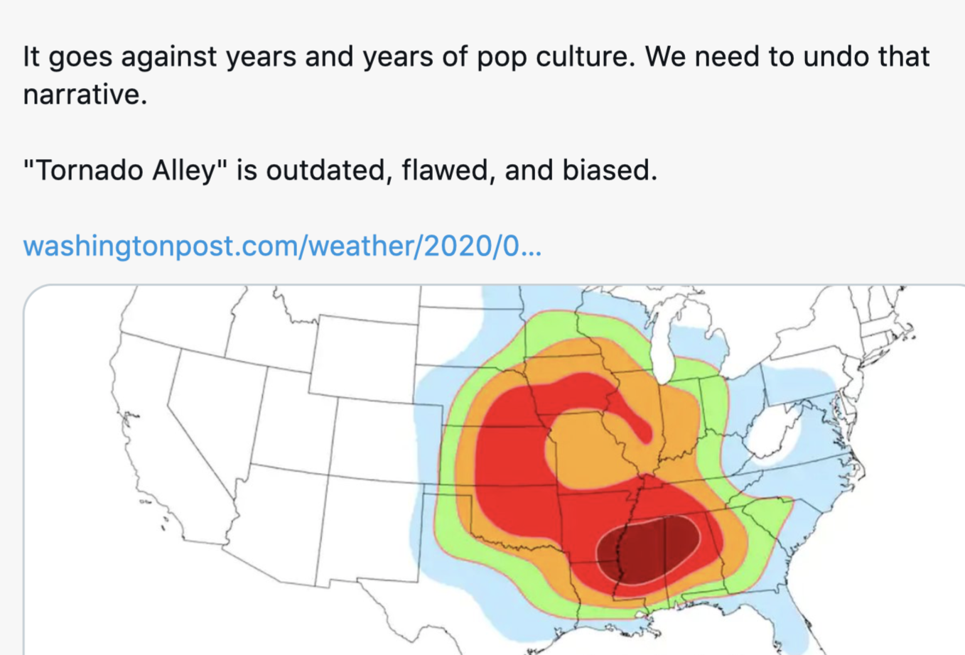
The hypothesis that tornado alley fluctuates geographically is not new. And, the recent rash of damaging tornadoes in the South may be part of a recurring pattern rather than a long-term climatological shift.
It was first proposed in a paper by -- who else -- the great Dr. Ted Fujita in 1975,
along with co-authors Allen Pearson and David Ludlum.
Special thanks to Linda Hall Library
Early in the paper, Ted wrote,
Earlier work by Brown (1933) and Brown and Roberts (1935) did not emphasize an Oklahoma-Kansas maximum. Instead, the high risk areas, as revealed by maps showing paths, suggested that Arkansas, Mississippi and Alabama were tornado prone... [emphasis mine]
This leads to natural speculation -- what is the true distribution of tornadoes over the Midwest? Are the variations random...or are the movements systematic?
In the 1970's, Fujita clearly recognized that "tornado alley" (the stripe from north Texas through Kansas to Iowa often seen in popular publications) might not be the most accurate depiction of tornado risk. His paper observed that, based on the limited data available, there may be a 45-year cyclic pattern of the 'tornado alley' shifting east and west and north and south. For meteorologists and climatologists who are interested, their methodology is contained in the paper which is at the red link (above).
Fujita described a maxima of relatively high tornado fatalities over the South from 1934-1940 (his Figure 14, below).
If his hypothesis is correct, the passing of time would yield two subsequent 45-year cycles -- which would bring us to about the 2020's. So, perhaps, it would not be surprising the South has suffered more than usual devastating tornadoes in recent years. The Birmingham Tornado last night has been rated at F-3 intensity -- a strong tornado.
With Fujita's assistance, I did some work in the 1990's that tended to indicate that since the paper had been published in 1975 the cyclic pattern seemed to have held. I have not done additional work since 1992. There is no reason to believe global warming is involved.
It is important to note, that Fujita, Pearson and Ludlum were charting a relative increase in tornado danger, not absolute. Just because the tornado risk may be relatively high in the South right now, strong tornadoes can certainly occur elsewhere if the right ingredients come together on a given day.
This is the story of last night's life-saving tornado
warnings in Alabama
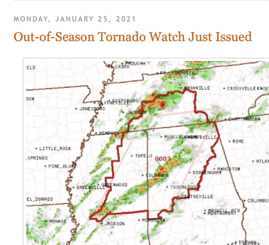
If you scroll down a bit, you'll see posted the tornado watch that included the Birmingham metro area. The purpose of a tornado watch is to let you know that you should be monitoring the weather for a possible tornado warning (the signal to take cover) if/when thunderstorms approach your location.
The watch also signaled it was time for emergency managers (one of whom tweeted she was on her way home for the day but was turning the car around and headed back into work), hospitals and others to put their advance plans into effect.
Thanks to the National Weather Service's wise investment in Doppler radar which allows us to see the wind patterns inside thunderstorms, we could see the swirling winds develop inside a thunderstorm moving across the northern suburbs of Birmingham. Below, I've circled the swirl.
The NWS's more recent investment in dual-polarization radar allows us (in this case, the great James Spann) to track lofted debris which -- at night -- is vital to signaling whether a tornado is on the ground.
While James Spann was showing the location of lofted debris
Richard Jacks posted a video on Twitter that briefly
showed the tornado illuminated by lightning.
The tornado warning was issued at 10:34pm which meant that everyone had at least 5 minutes of advance warning before the tornado arrived. Fultondale, where some of the worst damage occurred had about ten minutes. That is plenty of time to gather up the family, head for the basement, the bathroom or shelter in a closet.
Daylight showed pulverized neighborhoods.
Tragically, one person was killed and 28 were injured. But, scores may have been killed by an out-of-season tornado that stuck when many were sleeping. Take a close look at this tweet from this morning.
That spear-shaped piece of lumber came through the walls and stuck their bed ten minutes after he got his family to safety. He writes, "thank u weather radio!"
Shame on NBC's Today show this morning which trotted out the tired "little warning" line. The National Weather Service, television meteorologists and local emergency management deserve tremendous credit for their superb performance last night.
My weather sense, honed over 50+ years of doing this, tell's me 2021 is going to be a worse tornado season than 2020. Please allow this example to serve as a reminder for your family to think about what you would do if a tornado warning is issued for your area. I'll have more on that tomorrow.
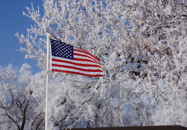
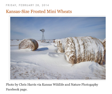
A number of meteorologists have been posting their favorite hoarfrost photos online during the past week. Here is mine. I took it along Nebraska Highway 50 in the southeast part of the state.
Long-time readers have met my granddaughters, Forecasters Evie and Jilly.
I would like to introduce you to my brand new grandson, Colin. Colin was so anxious to see the Chiefs
defeat the Bills that he arrived a month early. Son and mother are doing great and his papa is extremely proud. Now, Colin will be a big guy in time to watch the Chiefs take on the Bucs in Super Bowl 55.
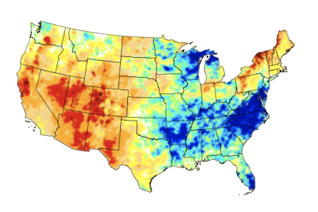
This was as of Tuesday of last week. The precipitation with the current storms will lessen the drought in the West. Below are the very preliminary amounts of precipitation during the past week.
This is the status of the winter storm as of 9am. The pink is freezing rain and we are getting reports of light icing from near Kansas City to St. Joseph.
I believe Interstates 29 and 35 will be closed in southern Iowa sometime during the day Monday. Parts of I-80 might be closed in southeast Nebraska along with Nebraska Highway 50, among others.
Snow Accumulation
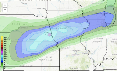
This will be the biggest winter storm in the region in three years. The purple area is 15 to 18" inch amounts. Isolated spots could have 20 inches.
The NWS winter storm index is very high with the storm. Blizzard conditions possible, especially in the southern half of the red-tinted area. This is a dangerous storm!
If you live in the red area, go to the store now, fill your car and generator with fuel now. At 3:07pm, the very first radar echos are showing up on radar in Kansas and northern Oklahoma.
Things will go downhill from here.
While not a major ice storm by any means, the darker green areas are where there will be
enough freezing rain to cause slippery conditions on untreated roads.
With wind gusts of 30-35 mph and heavy snow, blizzard conditions will occur in northern Kansas, southeast Nebraska, southern Iowa and far northwest Missouri. It wouldn't surprise me if I-29 is closed tonight.
Beginning late Sunday afternoon in the High Plains and spreading east late Sunday night and Monday heavy snow will develop over the Great Plains and Midwest.
This is the western part of the storm. The highest shades of blue = 12 to 15 inches of snow.
There could be a spot or two in northeast Kansas, far northeast Missouri or southwest Iowa that could receive 20 inches. In addition, peak wind gusts while the snow is falling will be 40 mph in this same area so blizzard or near blizzard conditions are possible.
Here is the forecast radar for 8am Monday.
The red-orange shades represent freezing rain which looks like a pretty good bet. What is unclear is whether significant ice accumulation will occur.
The precipitation forecast for next week is for desperately needed snow and rain to fall in the West.
I'll update again tomorrow morning on this developing storm.
Because of his dementia, I suppose Biden wants to earn his stipends from China quickly but the second day?!
Even though I knew we would disagree about many political policy items, I was completely sincere when I wished President Biden well on Wednesday. I still do. But, the moratorium on criticism I had planned is now rescinded. There is nothing about allowing the Chinese to be involved in our electric grid that can bring anything good to any American with the exception of the many politicians -- of both parties -- that are in China's pocket.
I'm shocked in a good way: Michigan Democrat Rashida Tlaib has called for not increasing national security powers in the wake of the January 6 riot at the Capitol. Her statement is here. What this means is that she has listened and she gets it: Conservatives and many Republicans fear an implosion of the Bill of Rights. Further restrictions will make our divisions worse. Even better, she wrote a letter to her colleagues that was signed by other members of The Squad.
After September 11, the bipartisan Patriot Act was one of the worst laws Congress has ever passed. It has led to widespread spying on the public by the federal government in blatant violation of the Fourth Amendment and should be repealed.
So, congratulations Rep. Tlaib. Let's hope we can arrest the downward spiral in our politics and find solutions that will bring America to even greater heights.