
Major Winter Storm Coming Into Focus (4:50pm Saturday)
Here are the latest NWS watches and warnings.

- Pink = winter storm warning
- Dark green = winter storm watch
- Purple = winter weather advisory (lesser condition)
- Bright blue = avalanche warning
- Gray = dense fog advisory
- Deep green = flood alert
Beginning late Sunday afternoon in the High Plains and spreading east late Sunday night and Monday heavy snow will develop over the Great Plains and Midwest.
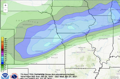
There could be a spot or two in northeast Kansas, far northeast Missouri or southwest Iowa that could receive 20 inches. In addition, peak wind gusts while the snow is falling will be 40 mph in this same area so blizzard or near blizzard conditions are possible.
Here is the forecast radar for 8am Monday.

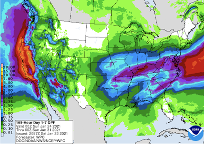
The precipitation forecast for next week is for desperately needed snow and rain to fall in the West.


Comments
Post a Comment