Friday, March 31, 2023

Severe Weather Summary

As of 8:45pm, the red dots indicate tornadoes. However, there are many more that will be added over the next three days.

Power outages (these are homes and businesses, multiply by 2.5 to get people):
This represents more than 500,000 people.

Flight delays at O'Hare are four hours due to weather. At DFW International, there are 15 minute delays but the time interval is rising. 

Tornado Threat for the Rest of the Night

Color code:

  • Extreme risk of strong tornadoes in purple.
  • High risk of strong tornadoes in red.
  • Enhanced risk of strong tornadoes in yellow.
  • Significant risk of tornadoes in brown.
Please monitor the weather the rest of the night in these areas!

I Seem to Be Okay on Twitter Again

 I'm back to providing storm coverage. 

PDS Tornado Watch: Tennessee, Mississippi and Alabama

This "particularly dangerous situation" tornado watch is in effect until 1am and includes Nashville, Muscle Shoals and Tupelo. A supercell that has caused strong tornadoes is now northeast of Memphis and is moving toward Middle Tennessee. Here is the radar at 6:21pm.

Path of Little Rock Tornado

The Little Rock Tornado's path was between the blue lines. 


Below is a more detailed map of the beginning of the tornado's path.
It seems hard to believe but apparently reliable sources are saying there are hundreds of injuries. 

My Twitter Coverage is Interrupted

Oh, Geez. Twitter has stopped my tornado coverage ( @usweatherexpert ) because I have sent too many tweets (tornado warnings) today. 
I didn't know there was a daily limit on Tweets. There didn't used to be. I will send a note to Elon Musk tomorrow but I may not be able to tweet more tonight.  

To give you an idea how huge this tornado outbreak is, take a look at the map below.
Yellow = tornado watches. Reds = tornado warnings. A bad tornado has struck Little Rock -- with 600 injuries --  and other areas in Arkansas as well as areas of Iowa. As I write this, St. Louis needs to keep a close eye on the weather as well as people just north of Memphis. 

Two PARTICULARLY DANGEROUS SITUATION Tornado Watches

4:30pm: In addition to the two tornado watches below, there are tornado watchers for northern Illinois (including Chicago) and southern Wisconsin (including Milwaukee). 


Particularly Dangerous Situation (PDS) tornado watches are rare. There are entire years without one. To get two simultaneously further signals just how dangerous situation situation is. Right now, former President Trump is the lead story on the national news. I believe that it will be tornado damage tomorrow morning. Now, we need to keep the death toll as close to zero as possible.  

In addition, wind gusts of 70 mph and hail the size of apples are forecast to occur. At least scattered power outages are likely. This may be the worst day of tornadoes since 2011.

If you live in a mobile home and you are west of the Mississippi River, now is the time to seek other shelter (unless your mobile home park has one you can access quickly). 

Updated Tornado and Damaging Wind Forecast

This is a Dangerous Weather Day.

All data indicates that this will be a day that will result in major, damaging tornadoes as well as thunderstorm-generated winds that will cause widespread power outages.

National Weather Service is describing the weather in this region regarding tornadoes as a "Particularly Dangerous Situation" and they are going to issue that type of very rare tornado watch for this afternoon and this evening. It includes St. Louis, Des Moines, Cedar Rapids, the Lake of the Ozarks, and Columbia. 

National Weather Service is already describing the threat in the area below as a "particularly dangerous situation." If you live in a mobile home, please exit by 1pm for other shelter! This includes most of Arkansas, northeast Texas (including Texarkana) and the Memphis metro area.


Tornado Risk, Now Till 7am Saturday

Color code:

  • Extreme risk of strong tornadoes in purple.
  • High risk of strong tornadoes in red.
  • Enhanced risk of strong tornadoes in yellow.
  • Significant risk of tornadoes in brown.

Damaging Wind Risk, 1pm This Afternoon Till 7am Saturday

  • Purple = Extreme risk of winds of 75 mph or stronger. Long-term power outages likely.
  • Red = High risk of 75+ mph in red, power outages likely in scattered areas. 
  • Yellow = Enhanced risk of wind gusts of 60 mph or stronger. 

There will be widespread power outages in these areas, especially purple!!

Essential Safety Recommendations

Now is the time to prepare! If a tornado warning is issued, or if a warning for wind gusts of 70 mph winds or stronger is issued, take shelter in the basement, preferably under a pool table or heavy furniture or, if you have a finished basement, in a closet or bath.

If you do not have a basement, a small closet or bath on the lowest floor is the place to go as in the photo below.

Make sure you have at least three ways of receiving storm warnings from the list below:

  • Weather Radio
  • Wireless Emergency Alerts (enable by going to "notifications" on your iPhone and scroll down)
  • Phone Alerts
  • Weather Apps (AccuWeather's with "locations" enabled) is free and a good choice

  • Make sure family and friends are monitoring the weather, also. Call them.
  • Make sure you can get family, especially infirm members, to shelter quickly if a tornado warning is issued.
  • If you live in a mobile home without a community shelter, seek other shelter if, 1) a tornado watch is issued, and 2) thunderstorms are forming to your west
  • If you have a motorcycle, football or other helmet, wear it into your shelter.
  • Insure your shelter area is ready to go. A flashlight, a couple of bottles of water, diapers, radio or TV, and always wear shoes into your shelter. 
  • If you are short on prescriptions, get them refilled asap.
  • Fill/charge your chainsaw.
  • Fill/charge your automobile.
  • Charge your smartphone and laptop but take them off the charger when thunderstorms approach. 

I will be providing additional live weather information on Twitter @weatherexpert. 

Since we are on the topic of dangerous weather: 

Color codes:
  • Orange = blizzard warning.
  • Pink = winter storm warning. 
  • Purple = winter weather advisory (lesser condition).
  • Sand = wind advisory. 
  • Deep green = winter storm watch.

Tornado Watch to Be Issued

NWS SPC says they are going to issue a tornado watch for most of this area. 

Thursday, March 30, 2023

Extreme Risk of Tornadoes and Damaging Winds Friday and Friday Night

8:40am: These forecasts still look good. 

Tornado Risk from 11am until 4am Saturday
The map above displays only the highest risk areas -- where strong tornadoes are forecasted.  

Damaging Wind Forecast From 10am Friday until 7am Saturday
Nadocast.com
The hatched purple areas is where thunderstorm-generated straight-line winds of 75 mph or stronger are forecasted to occur. The red area is where there is an enhanced risk of wind gusts of 60 mph or stronger. 

There will be widespread power outages in these areas!!

If a tornado warning is issued, or if a warning for wind gusts of 70 mph winds or stronger is issued, take shelter in the basement, preferably under a pool table or heavy furniture or, if you have a finished basement, in a closet or bath.

If you do not have a basement, a small closet or bath on the lowest floor is the place to go as in the photo below.

Recommended safety suggestions: 

Make sure you have at least three ways of receiving storm warnings from the list below:

  • Weather Radio
  • Wireless Emergency Alerts (enable by going to "notifications" on your iPhone and scroll down)
  • Phone Alerts
  • Weather Apps (AccuWeather's with "locations" enabled) is free and a good choice

  • Make sure family and friends are monitoring the weather, also. Call them.
  • Make sure you can get family, especially infirm members, to shelter quickly if a tornado warning is issued.
  • If you live in a mobile home without a community shelter, seek other shelter if, 1) a tornado watch is issued, and 2) thunderstorms are forming to your west
  • If you have a motorcycle, football or other helmet, wear it into your shelter.
  • Insure your shelter area is ready to go. A flashlight, a couple of bottles of water, diapers, radio or TV, and always wear shoes into your shelter. 
  • If you are short on prescriptions, get them refilled asap.
  • Fill/charge your chainsaw.
  • Fill/charge your automobile.
  • Charge your smartphone and laptop but take them off the charger when thunderstorms approach. 

I will be providing additional live weather information on Twitter @weatherexpert. 

Serious Tornado Risk Friday and Friday Night

[scroll up on the blog for more current forecasts]

In addition to tornadoes, there is a serious risk of damaging winds and power outages. 

Tornado Risk
Using my 4-point scale, there is:
  • A high risk of strong tornadoes in the red, hatched areas. 
  • An enhanced risk of strong tornadoes in the yellow, hatched areas. 
  • A significant risk of tornadoes in the brown areas.
Damaging Wind and Power Outage Risk
  • An extreme risk of damaging winds (≥ 75 mph) and power outages in the purple area.
  • high risk of damaging winds in the red, hatched areas. 
  • An enhanced risk of wind gusts of 60 mph or stronger in the red area.
  • significant risk of gusts of 60 mph or stronger in the yellow area.
If there are people in your family and social group that are not "weatherwise" and they live in these areas, please give them a call or text and suggest they follow the weather tomorrow. 

I will update tomorrow morning. 

Make Your Tornado Safety Plans NOW

The morning models are almost finished coming in. I'll be looking them over along with NWS SPC's forecasts and will post an update to the tornado risk tomorrow by 1:15 or so.

However, there is enough data from last night and today to emphasize that we are in a very active wether pattern conductive to spring tornadoes. Now, is the time to make plans. Especially....
  • If you live in a mobile home, make arrangements to shelter with someone in a conventional home or a nearby public shelter. 
  • Get a programmable weather radio.
  • Turn on FCC's Wireless Emergency Alerts on your smartphone (bottom of "notifications" on an iPhone). 
  • Subscribe to StormWarn.
Sirens are great outdoors but you cannot count on hearing them indoors and you certainly cannot count on them awakening you. 

One additional thought: If you want a portable generator, get one now. Make sure you read the instructions and follow them. There are far too many deaths from carbon monoxide poisoning after major tornadoes, ice storms, and hurricanes. 

Come See Me at WeatherCon in Dallas!

I will be speaking (along with some other great speakers) at 11am on Saturday, May 6, at the Frontiers of Flight Museum in Dallas at Love Field. 

My topic will be how weather science, especially Dr. Ted Fujita, conquered the downburst and prevented thousands of deaths and billions of losses of aircraft. 

Come and join us. Admission is free. 

Wednesday, March 29, 2023

Serious Tornado Risk Friday

Here is my first-estimate of the tornado risk for Friday and Friday night.
Please factor this forecast into your preliminary plans. 

I will have an update tomorrow afternoon. 

Thoughts After the Release of the UN's Latest Climate Report

With the recent release of the UN's IPCC's "Summary for Policymakers" (a political, not scientific,  document), the amount of garbage info about a warmer climate has mushroomed like toadstools. 
WoodforTree's blend of the four most widely
used earth temperature metrics.
Woodfortrees.org
Their claim that world temperatures have never been higher in modern history is just wrong. The peak was in 2016. Temperatures have dropped since. That is almost certainly due to the La Nina (cold water in the Pacific). That drop is likely inconsequential as temperatures will probably begin rising again with the El Nino forming in the Pacific. But, the position we are at a record is simply bad science.

The item below is just silly.
This gradual temperature rise was one of the greatest things to ever happen to humanity!

In 2018 (pre-COVID), a World Bank study showed,
  • The rate of extreme poverty was the lowest in the history of the world.
  • Plentiful food. Highest food production in world history on a per-capita and absolute basis. That is not so say there weren't hungry people, but the food was available to feed them (dictators withholding food is not a climate issue). Longer growing seasons plus the Green Revolution have made a giant difference to humanity. 
Still true today:
  • Lower energy use. Worldwide, far more energy was and is used for heating than cooling. 
  • Far fewer deaths from exposure. Cold is seven times deadlier than heat. 
  • Number of violent tornadoes are significantly fewer. 
  • At worst, hurricane strength or frequency have not increased. 
  • Widespread meteorological famines seem to be a thing of the past. We haven't seen anything like the mid-late 20th century famines in more than a quarter century. That is not just from my analysis of the data, see here
  • Just last week President Biden traveled to deliver a speech on global warming in a 70+ car motorcade made up almost entirely of heavy limos and SUV's. If climate change was that serious, I'm certain the President would set a better example. 
Sea level increase has been a trivial problem, to-date. The Maldives were supposed to be unlivable by 1992. Instead, they are flourishing as never before. 

Ecosystem collapse, such as the issues with the Great Barrier Reef, have turned out to have been a temporary issue. The Reef has never been in better shape.

You might ask, Then why are you in favor of dramatically cutting down CO2 by switching to nuclear and hydrological power?

Because, while global warming has been a net positive so far, we don't know if that will continue. My second reason is that I want to preserve chemical feedstocks and fossil fuels for future generations. 

While it is extremely basic, climate science can't/won't even hazard a guess as to the ideal global temperature for humanity to flourish. Why? I suspect it is because they might find today's temperature is rather close. Or, if it is warmer than today, all of those huge research and mitigation dollars -- and the opportunities for graft that go with them -- diminish. 

Rather than running around with our heads on fire every time some agency wants more money for climate, it is time to approach the problem intelligently. Wind energy gets us nowhere and is actually a negative. Nuclear and hydro give us a huge chance to bring prosperity to many areas (including Africa) that have long deserved it by increasing energy availability and lowering costs. 

This is my position. 

UPDATE: Snow Forecast Thursday Night to Saturday Morning

While there will be some adjustments, here is a first look at the late-season snow forecast for late in the week. 

Above is new late this afternoon from the National Weather Service. 

March's Required Reading

The author is absolutely correct when he writes:

It has been two months since the frigid temperatures that accompanied Winter Storm Elliot caused rolling blackouts in several Southern states. Luckily, the portions of southern states that rely on the Midcontinent Independent System Operator (MISO) narrowly avoided power outages, but Americans living in areas served by the Tennessee Valley Authority (TVA) experienced losses of electricity as TVA was forced to cut power to residents for the first time in its 90-year history. 

Now that the dust has settled on the storm, renewable energy advocacy groups are attempting to gaslight the public about the causes of the blackouts by misrepresenting the reliability of coal and natural gas power plants generators relative to wind and solar facilities. In doing so, they are encouraging Americans to learn all the wrong lessons from the cold snap that pushed our electric grid to the brink.

Please read the entire piece. It is vital to America's future. 

Addition: More here


Tuesday, March 28, 2023

75 Years Ago Today...

Five days before,
a highly damaging tornado struck Tinker.
Seventy-five years ago today, an experimental and successful
forecast of a tornado. 
...the first successful tornado forecast of the modern era* occurred at Tinker AFB outside of Oklahoma City. 

I tell the emotional and humorous story of two Air Force meteorologists ordered to make an impossible forecast in Warnings: The True Story of How Science Tamed the Weather. My book tells the "human" side of the story (I was privileged to know then-Col. Bob Miller and we talked about the forecast on more than one occasion). There is a shorter summary of what occurred, here. With that forecast, Miller and (then) Lt. Ernie Fawbush made what would have been the first tornado "watch." The meteorological details are here

As Wiki (orange link) describes it, the forecasts were kept secret for quite a while. When word got out, WKY-TV and their chief meteorologist Harry Volkman came up with a surreptitious way of getting Miller's forecasts. WKY broadcast the forecasts and, when strong thunderstorms approached Oklahoma City, broadcast the first tornado warning. 

The Tinker AFB forecast led to the Air Force setting up a global severe weather forecast organization which led to the Weather Bureau setting up a national tornado forecast center in Kansas City (now in Norman, Oklahoma). 

*The Army Signal Corps made some experimental tornado forecasts in the 1880's. 

Another Pro-Global Warming Meteorologist Condemns Global Warming Hype

Dr. Cliff Mass, for whom I have a great deal of respect and whom no one could say doesn't believe the earth's climate is changing due to humanity's influence points out more global warming hype that simply isn't true
This type of media behavior, and the scientists that encourage it, is a highly unfortunate aspect of climate 'science.'

Map of Category 5 Landfall Locations

With Saturday being the first day of the 2023 hurricane season, the above map reveals the location of landfalls of Atlantic Basin category 5 hurricanes. 

Please make sure -- now -- your family has a plan should you be in the path of one of this season's hurricanes. 

Monday, March 27, 2023

We Should Appreciate TV Meteorologists

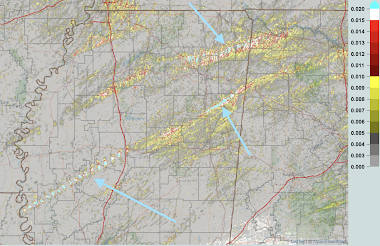
Brian Stelter îs the former media correspondent for CNN. For the first time to my knowledge, a professional media critic reviewed the television tornado warnings from a major tornado outbreak. In this case, it was the Jackson, MS stations. As you know, that tornado has received a preliminary EF-4 rating (top 1.5% in intensity) and killed 26. I believe that what he found surprised him as to the quality of the warnings and other weather coverage. 

You can read his comments (a series of tweets) here. An example of one of them is below.

I'd like to add a comment: Television meteorologists (the ones with a BS in meteorology or higher) are -- generally -- quite under appreciated and, in the small to medium markets, usually vastly underpaid. In tornado alley, they work grueling hours in the spring. 

A degree in meteorology, with all of the physics, chemistry and calculus that goes with it, is a really, really tough degree. Much more difficult than, say, business. In order to have their various seals of approval, they must do continuing education. The pressure of being continuously on the air for hours in a life and death situation like Friday's is incredible. They will almost certainly suffer from PTSD after an event of this nature. 

So, I urge you, when an event like this occurs in your area, drop a note of appreciation in the mail or send an email. If you see them in a restaurant, offer to buy them dinner or a drink. They will greatly appreciate it (especially if you do not interrupt their meal other than to give them a brief compliment). 

Sunday, March 26, 2023

UPDATE 11:49am: Today's Tornado Risk

In the South, there is another 
high risk of tornadoes today.

The color code:
  • There is a high risk of strong tornadoes in the red hatched area.
  • There is an enhanced risk of strong tornadoes in the hatched area.
  • There is a significant risk of tornadoes in the brown area. 
I urge you to follow trusted local sources of weather information throughout the day. I will have an update this afternoon. In the meantime:
  • Prepare to care for infirm friends and relatives now. Don't wait until the storms are approaching. 
  • There is a significant risk of power failures. It won't hurt to get a few extra bucks at the ATM.
  • Put your car in the garage along with any lawn furniture or other items that may be damaged.
  • Fill your car with fuel.
  • If you are running low on prescriptions, go ahead and get them refilled.
  • If you have a portable generator, make sure you place it outdoors, well away from any air intakes.
If you live in a mobile home: I recommend finding other shelter when there is a tornado watch in effect for your area and thunderstorms begin to form to your west. Don't wait until the tornado warning is issued. 

There will also be updated weather information on Twitter @usweatherexpert. 

Sunday Fun: Mamma Mia, What a Great Grandson!!

After all of the terrible weather of the past week, I thought we'd all enjoy a smile. 

My son sent me this photo of his son helping fix dinner. 
At the age of two he is fixing meatballs! I don't know how spicy they might be (I prefer mildly spicy; the ones at Maggianos are perfect -- just like my Grandmother used to make) but I'm sure he'll learn. 

Even though my last name is Smith, I am Italian and I love Italian food. My daughter studied in Italy and gave me the shirt I am wearing. 
So, seeing my grandson getting an early jump on making Italian food made my day. Hope this "proud granddad" piece gives you a smile. 

Saturday, March 25, 2023

Report on Last Night's Horrific Tornadoes

As of 8pm, 26 people have perished in last night's horrible tornadoes. The aim of this report is to put these storms in perspective. 

Because I am sure that what seem to be random town names are making little sense, I believe a map is the place to begin when discussing last night's storms. This is derived from radar-measured rotation.
The blue areas in Mississippi is where the big tornado or tornadoes were. The reason the tornado path west of I-55 looks like a row of chiclets is because of limited radar coverage combined with the storm's fast movement. It was a continuous path. 

Update: Here is an updated map from Mississippi Emergency Management.
It compares nicely to the radar track estimate (above).

Both from radar and from photos of the damage, I'm certain this will be at least an EF-3 intensity tornado. It is possible it will be a 4 or 5. I base the latter on its appearance on radar and its resemblance to other violent tornadoes. The NWS will have the final word after they do their damage surveys which will take days.7:50pm Saturday: The NWS has given it a preliminary rating of EF-4.
AccuWeather

The National Weather Service did a fine job with this event. There were accurate tornado forecasts the day before and the day of, plus the warnings were timely. Storm chasers were tweeting live photos of the tornadoes from the field. Storm chasers Reed Timmer and Ryan Hall transported victims to hospitals before other first responders arrived! A number of storm chasers are licensed EMTs and they went into damaged areas.

I estimate that, absent the forecasts and warnings, more than 150 people would have died from these storms. While it will be possible to do a better comparison when the survey data is in, this resembles the Great Plains Tri-State Tornado (a/k/a "Woodward Tornado"), that tornado killed more than 180. Weather science deserves a great deal of appreciation this morning. Instead, predictably, the opposite is occurring. 

The reporting by Fox News this morning that there was "no warning" is deplorable. I'm shocked the meteorologist agreed with the news anchor. He, especially, should know better. 
When people incorrectly report there was "no warning," it hurts the credibility of the warning system. I have emailed Fox News and asked them to retract the report. 

Addition: In case you doubt the "no warning" hurts our credibility, this was sent to a meteorologist in the region at 12:57pm. 

It is important emphasize that the ideal tornado warning is not an hour or similar time interval. Why? The warning would lose its urgency and people would choke highways trying to flee. As the photo above, and the video below, indicates, cars are terrible places to be when a tornado approaches. The video, taken by storm chasers, shows the headlights of a car picked up by the tornado! I shutter to think what happened to the occupant(s).

Per research from Dr. Kevin Simmons (here and elsewhere), the ideal lead time for a tornado warning is 13 to 15 minutes. Fatalities increase beyond 15 minutes. In Dr. Simmons' words,

...lead times longer than 15 min increase fatalities 
compared with no warning. 

Beyond about 15 minutes warnings lose their urgency. People without basements will only stay in bathtubs and dark closets for so long. 

So, since some in the national media have mentioned the alleged lack of warning for the town of Rolling Fork, let's look at those warnings.

My, and the National Weather Service's, first warning for Rolling Fork was at 7:53pm. The reason I spend hours in a situation like this is so I can add the radar and other information to improve situational awareness for the warnings.
Here is the NWS's warning:
Note that they say the "dangerous storm" will be near Rolling Fork at 8:05pm. 

Per the official list from the Storm Prediction Center, the tornado arrived in Rolling Fork at that exact time.
So, the people of Rolling Fork had 13 minutes of advance warning which is nearly ideal. There were many follow-up messages for that city. The warnings were excellent as the tornado moved northeast. 

Not only were the tornado warnings excellent, the advance forecasts were quite good. The forecast of "high risk of strong tornadoes" was posted on this blog more than 36 hours in advance.

One final point I have to make is that a mobile home doesn't stand a chance in tornadic winds of this nature. 

David Rouecne posted the following images to illustrate that point. The photo below shows a mobile home park in Rolling Fork.

Below is how the mobile home park appeared this morning. 
Obviously, no one could survive without injury. 

We emphasize, over and over, that people in mobile homes should find other shelter when:
  • They are in a tornado watch
  • Thunderstorms start forming to their west
They can't wait until a tornado warning is issued. In 2013, I presented a paper at an American Meteorological Society meeting suggesting changes in the tornado watch program that would better address the situation where additional warning time is needed. I believe those suggestions still need consideration.