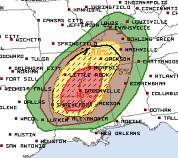
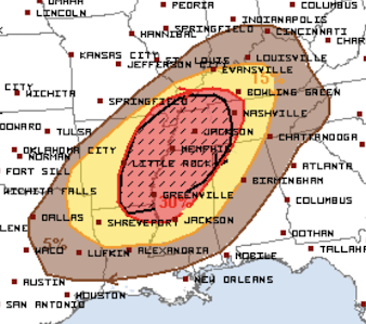
3pm Updated Tornado and Damaging Wind Forecast
The above is the updated as of 3pm tornado forecast from the NWS SPC. While this forecast is in effect from now until 7am Saturday, the threat for tornadoes probably will not start until 1-2 pm. This is earlier than earlier thought. Based on very late data coming in as I'm typing this, I might extend the red area to Jackson, Tennessee.
The color codes:
Red + hatched = high risk of strong tornadoes. A strong tornado is defined as a "2" or stronger on the EF tornado damage intensity scale.
Yellow + hatched = enhanced risk of strong tornadoes.
Brown = significant risk of tornadoes
How to Prepare. Because of the likelihood of power failures (see wind discussion below), the preparations are important.
- Prepare to care for infirm friends and relatives now. Don't wait until the storms are approaching.
- There is a significant risk of power failures. It won't hurt to get a few extra bucks at the ATM.
- Put your car in the garage along with any lawn furniture or other items that may be damaged.
- Fill your car with fuel.
- If you are running low on prescriptions, go ahead and get them refilled.
- If you have a portable generator, make sure you place it outdoors, well away from any air intakes.
Damaging Wind Likelihood
For more information, please follow me on Twitter @usweatherexpert.


Comments
Post a Comment