
Late Night Storm Update
First of all, there is a serious risk of flash flooding from 7a Friday to 7a Saturday in the red area.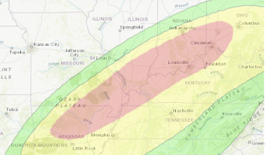
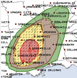 The only change I would make to tomorrow's outlook at this point is that I would bring the red area north to include Memphis and to I-40 in Arkansas east of Forrest City.

As to the tornado risk, it will be high tomorrow in the red area. Below is the forecast I posted at midday today.

Please check back with me in the mid- to late morning as I think tomorrow may turn into a dangerous tornado day after about 3 to 4pm.


Comments
Post a Comment