
UPDATED: 2:50pm PST -- 7-Day California Rainfall Outlook
Here is the latest National Weather Service precipitation amount forecast for central and northern California for the next seven days (till 11am PDT Friday). 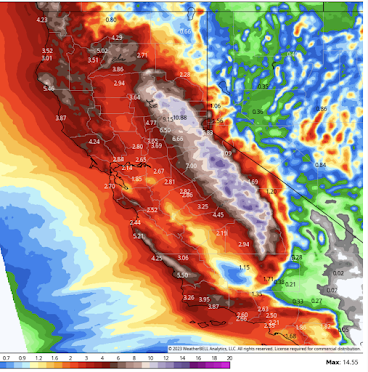 There are still several areas where additional precipitation of ten inches or more are forecast to fall. However, the Southland (see below) will now be experiencing some of the heavy rains.
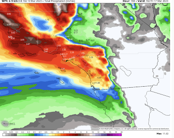 In Southern California, rainfalls will not be extreme but should be enough to cause localized flooding.
 The orange polygons are flash flood warnings.
 Given the saturated ground, plus the fact rivers are already running high, I would prepare a go-kit (heirlooms, vital documents, some clothes, etc., that you can easily carry) in case an evacuation is necessary.


In the short term,
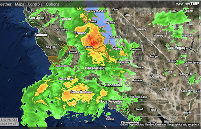
Extreme rainfall continues south of Fresno as of 1pm PST radar. Heavy, wet snow continues in the mountains (blue). The general trend in the movement of the rain is toward the south.

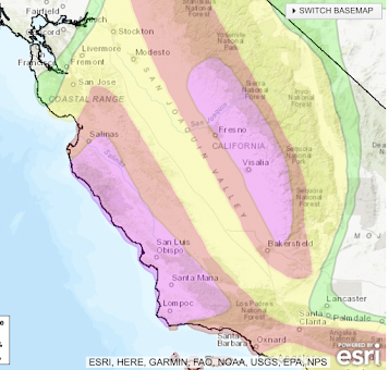
There is still a high risk of flash flood in the purple areas and there is a moderate risk of flash floods in the Southland mountains and immediately downstream.

It is vital that people in the threat areas continue to monitor local, trusted sources of weather information and move to higher ground if directed. Whatever you do, do not try to cross flooded areas by foot or by car.
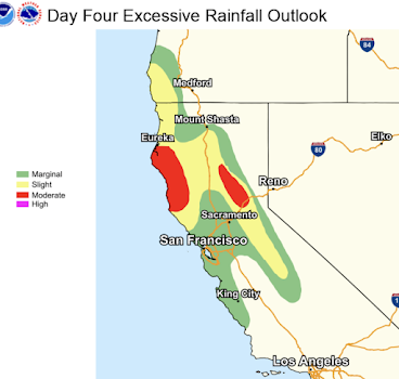
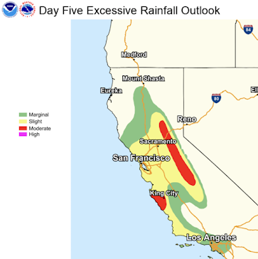
UPDATE: The NWS has issued two experimental day 4 (Monday) and day 5 (Tuesday) flash flood outlooks. They are below.


Comments
Post a Comment