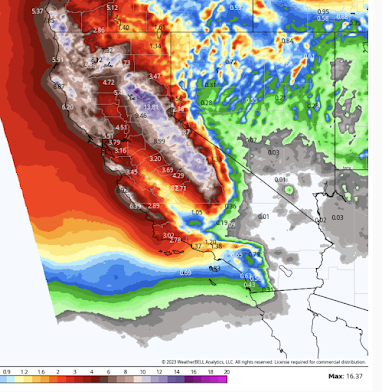
Dangerous Situation In California - Updated 2:10pm PST
 |
| National Weather Service's 7-day Precipitation Amount Forecast |
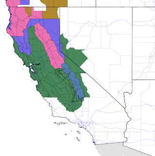
Here are the latest NWS forecasts:
Color code:- Pink = winter storm warning
- Green = flood watch
- Blue = winter storm watch
- Brown = high wind warning
The extended range models indicate that heavy rains and snows will continue beyond this forecast period and out to at least 15 days. If these forecasts are correct, it will become a dangerous situation where there will be considerable flooding, I-80 will be closed, Amtrak's Southwest Chief will be canceled, stores will run out of groceries and other inventory. In the mountains, already highly stressed residents will deal with collapsing roofs and a continuing "snowed in" situation. As the NWS in Sacramento says:
Now is a great time to start preparing for heavy rain by clearing drainages, ditches, and gutters free of debris and snow. Sierra locations that are already buried under a deep snowpack should take preparations to avoid snow load on structures, as rain absorbing into the snowpack may contribute additional weight and lead to structural collapses.
Beyond the first seven days of the forecast, rain/snow will continue only the entire state will be affected with moderate to, perhaps, heavy rain in the Southland.
Of course, I will continue to watch and update this situation.


Comments
Post a Comment