
Eclipse Forecast
We begin with cloud cover.
 It continues to appear that northern Maine will be the most favored location for eclipse viewing. I am spending addition time on Texas because of the tornado and giant hail threat.

4pm lightning forecast map. This is important because it is likely people will still be in gridlock learning the path of the eclipse.

The brown area in Louisiana and Texas has a significant risk of tornadoes on my 4-word scale (significant is just what it says, but is the lowest of the 4). Any tornado risk will be after the eclipse totality ends.

This is a forecast of hail 1" in diameter. In the hatched area, 2" or larger hail is forecast to occur.
If you have friends or family interested in the eclipse, please refer them to this site.


Essentially, there are three types of clouds: cirrus (high clouds), "alto" (middle clouds) and cumulus (low clouds). Low clouds will completely blot out the eclipse. Most alto will, also. When it comes to cirrus clouds, it depends on the thickness. BTW, all of these photos are my own.
Here are examples: these are high thin cirrus clouds. They will not cause a problem except to, perhaps, make the corona more difficult to see.

Below are cirrus clouds. The higher, thin cirrus clouds? Not much of a problem. The thicker cirrus will definitely dim the corona if one is between you and the sun.

Below are relatively thin altostratus/altocumulus clouds. The sun is at upper left. While there is a lot of glare, the solar disc was not crisply visible

The lower, the thicker clouds will completely obscure the clouds.
The Cloud Forecasts
This forecast was derived by a blend of the American models (hat tip: NWS's Greg Corbin).

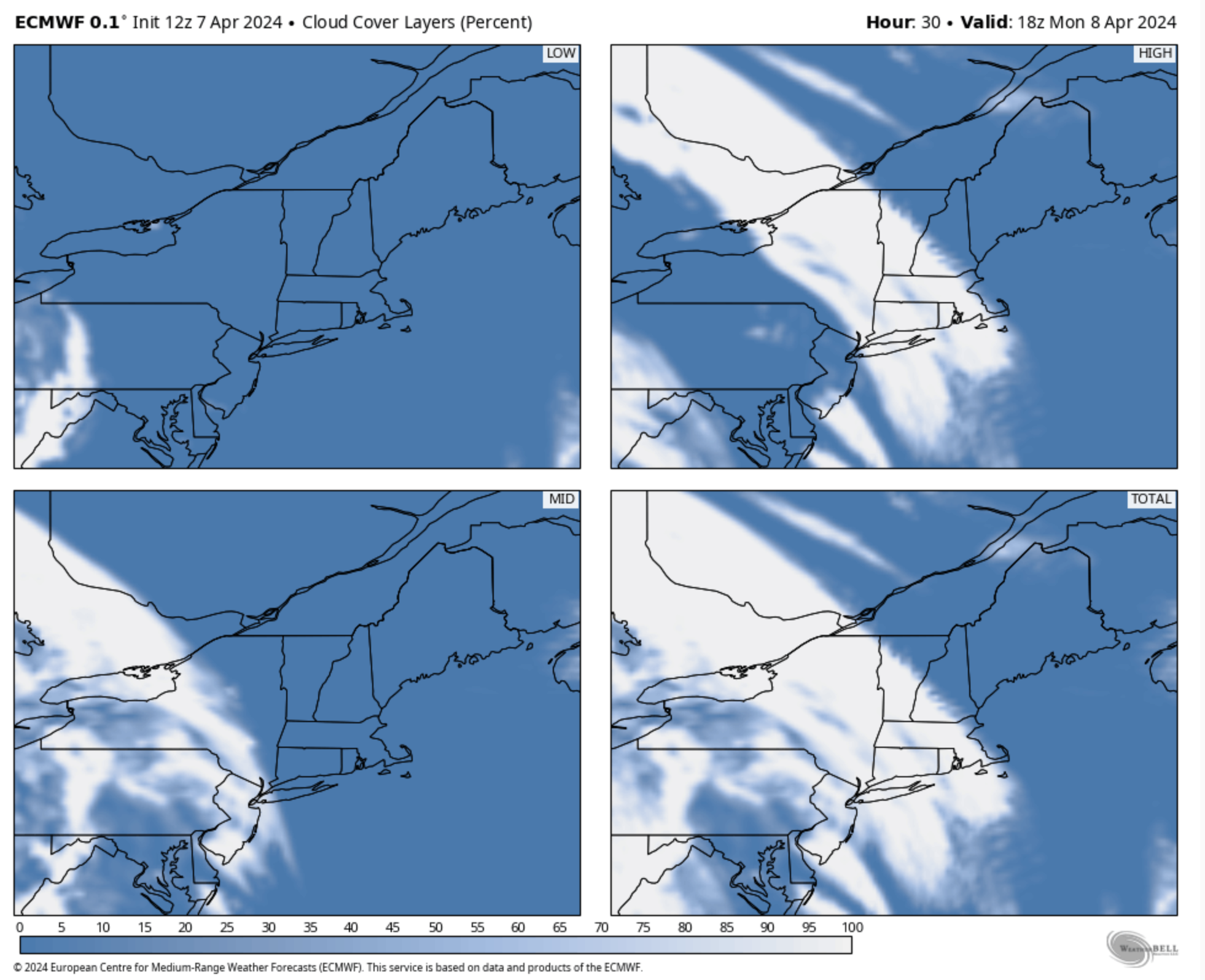
The ECMWF model's forecast at the time of the eclipse The ECMWF is the world's single best model.


Looks like the St. Louis NWS has the same concerns about cirrus clouds as I.


We also have the output of one of the quality "mesoscale models."

The Tornado and Severe Thunderstorm Threat
These are lightning forecast maps. The upper map is 1pm, the time of the eclipse.


The yellow area has a significant risk. The red area, an enhanced risk (2 on my 4 point scale).


There is also a flash flood watch for the area.

So, that is my detailed forecast. Very best wishes for great viewing!!


Rather than interpreting the above, check here for your viewing opportunity for today’s eclipse:
ReplyDeletehttps://www.nytimes.com/interactive/2024/science/solar-eclipse-cloud-cover-forecast-map.html?unlocked_article_code=1.i00.4gCS.zkcjGdlzdnET&smid=nytcore-ios-share&referringSource=articleShare&sgrp=c-cb