5:20pm Idalia Update
 |
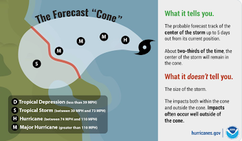
| S = tropical storm. H = hurricane. |
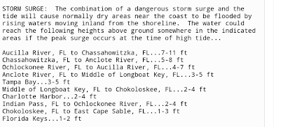
The new storm surge maps are not available but they should be similar to the one in the posting below. NHC is now forecasting a storm surge up to 11 feet along and just to the east of where the eye makes landfall.
Tornadoes will be likely, especially north of Alligator Alley and east of Tallahassee.
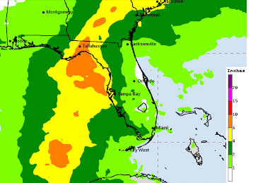
Here is the latest rainfall amount forecast.
"The Cone" is an unfortunate name for the area outlining NHC's risk envelope for the path of the eye. An explanation is below.
I would call it, "the zone" but that is just me. Please note that I'm giving some extra leeway on the east side of the "cone."


Comments
Post a Comment