Tornado and Damaging Wind Threats Around the Nation
It is going to be a long day, weather-wise.
-- 3:12pm Update: No forecast changes. --
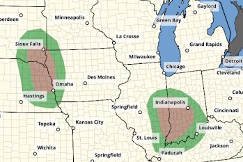
Tornado Threats
The brown areas represent significant tornado risks. These include Indy, Evansville, Omaha and Sioux Falls. Please keep up on the weather this afternoon and evening in these areas.
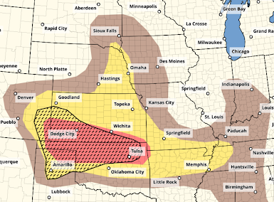
Derecho (Damaging Wind) Threat
The red area has an enhanced threat of wind gusts of 60 mph or stronger. Where there is hatching, winds of 75 mph or forecasted to occur.
The yellow area has a significant threat of 60 mph or stronger winds. Again, where hatched, there is a chance of 75 mph gusts but the likelihood is a little less.
A derecho (geographically long-path of intense winds) brings with it the likelihood of power outages and tree damage. Please prepare now. If you live in a mobile home, especially if it is not tied town, please make arrangements for other shelter well before the storms arrive.
I plan on updating in the mid- to late afternoon.


Comments
Post a Comment