
Rainfall Forecast Update 10am PDT
Here is the Southwest radar as of 10am. 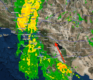 The first of the thunderstorms with torrential rains are approaching the California/Mexico border,

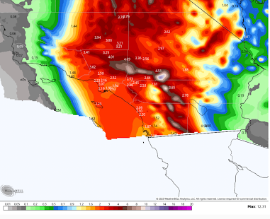

Here are the NWS's forecast rainfall amounts (this forecast created by meteorologists).


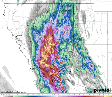
The newest high resolution model (HRRR) is shifting the heaviest rain farther west. Note the axis is shifted farther west. That is a bigger threat to areas west and south of the coastal mountains.

There are already ~25,000 power outages in the state, mostly central. There will be more but rain, rather than wind, is the greater threat.


Comments
Post a Comment