
12:50pm PDT Rainfall Forecast
Radar as of 12:35pm. Gold outlines are current flash flood warnings. 
Here is a forecast for additional rainfall. 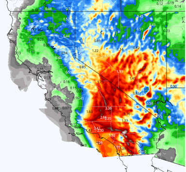


The above maps have high precision but they can be hard to read. So, I'm posting the same data that is a bit easier to read. 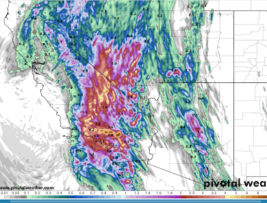


At this point, I would stay off both I-8 and I-10 across Southern California.
 |
| Radar at 12:46pm PDT |
Note the red thunderstorms north of I-8 in south California. That cluster of storms will cause torrential rains and there is a chance of a tornado with any strong thunderstorm over the desert this afternoon.


Comments
Post a Comment