
Another Giant Tornado Warning Miss
We've had another straightforward tornado situation missed by the National Weather Service. This time it was in far northwest Kansas, near the Colorado border and just south of I-70.
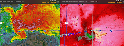 A classic "hook echo" -- known to be a precursor of tornadoes since the 1950's -- has formed on the left frame. The left frame is the reflectivity data which is the type of radar generally shown on television. The right frame is the Doppler velocity data which shows the circulating winds in the hook which have formed or are forming the tornado. Unquestionably, a tornado warning should have been issued at this point.
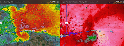 They don't make hook echoes more obvious than this one. The winds continue to rotate within the hook (right frame).
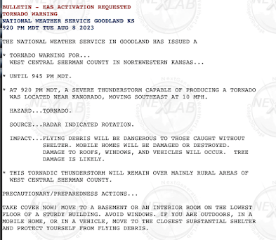 I'm at a loss for words to explain this.
10:07pm CDT - 9:07pm MDT

10:10pm CDT - 9:10pm MDT

10:13pm CDT - 9:13pm MDT
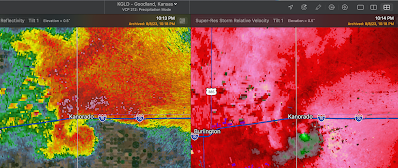 Voila. A tornado vortex signature (right frame) within the classic hook. There is clearly a tornado in progress at this point. My understanding is that storm chasers were calling in the NWS suggesting a tornado warning be issued.

10:20pm CDT - 9:20pm


Comments
Post a Comment