
Watch Issued -- Tornadoes Possible
As long-time readers know, I am not a fan of these "severe thunderstorm" watches that forecast tornadoes. In my opinion, they should be tornado watches. Regardless, we have one of them this evening. 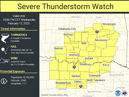 The watch is in effect until 10pm CST. FYI: as the storms develop further, much of my coverage will be on Twitter @usweatherexpert.
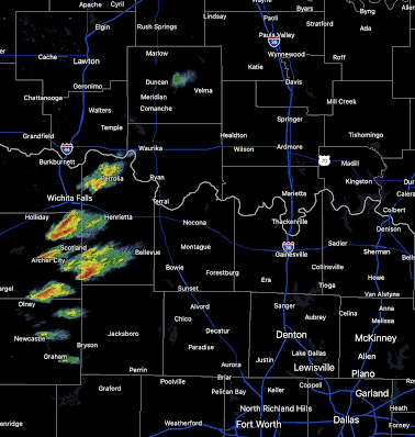

As of 4:04pm, rapidly developing thunderstorms were located over north central Texas. They are moving to move northeast to east northeast. Note, that -- in addition to tornadoes -- 2" hail is possible. So, it is a good idea to put the car in the garage.

The highest period of tornado risk will be from about 7pm until 1am Thursday. Because of the overnight nature of the threat, I highly recommend signing up for StormWarn, the nighttime telephone call only if a tornado or winds 80 mph or stronger are approaching your home. That way, you can go to sleep for the night and know that you will only be awakened if a dangerous storm is approaching. I helped set up this system but I receive no money for promoting it or anything else. I believe in active nighttime warnings for dangerous storms.
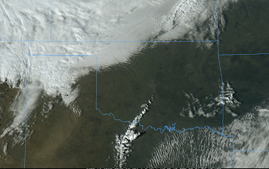
As of 4pm, weather satellite images show towering cumulus clouds well north into Oklahoma, so rapid thunderstorm develop is possible in the Sooner State.


Comments
Post a Comment