Wrapping Up Storm Coverage As of 11pm
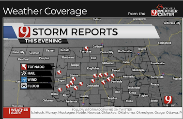
As of 10:45pm, red dots are confirmed tornadoes. There were many tornadoes, some that did significant damage, in Oklahoma that are not yet on the map. One of those struck southeast Norman but missed the OU campus.
Below is where the great number of power failures in Oklahoma have occurred.
There are also 1,500+ homes and businesses without power in Sumner and Cowley counties of Kansas.
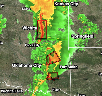
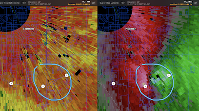
Here is the ROC/NSSL -88D (located on North Campus of OU) depicting the tornado as is was just south of the launch site. This was 9:21pm.
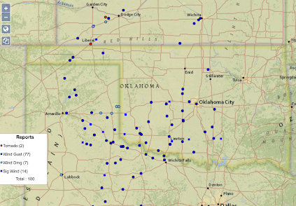
The blue dots are thunderstorm-generated winds of 58 mph or stronger. The strongest has been a gust of 114 mph clocked at the Wheeler, TX weather station.
In addition, here is a very preliminary map of tornado touchdowns in Oklahoma.
I-35 at Tonkawa, OK is closed due to power lines across the highway.
As for power outages, so far about 100,000 homes and businesses are without power in Oklahoma, north Texas and New Mexico.
As of this time, the lines of thunderstorms continue to move east.
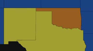
Reds are areas of high winds as of 10:55pm.
For Meteorologists
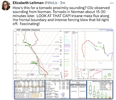
Be sure and look at this OUN tornado proximity sounding. It was taken 15-20 minutes before the tornado arrived almost on top of the launch site. Note the inversion. The strong dynamics blew it out and combined with 1,000+ 0-1km SRH to produce what (very preliminarily) looks like an EF-2 tornado in southeast Norman.





Comments
Post a Comment