Update on Winter Storms #1 and #2; 11:15pm
Note: scroll up for later forecasts.
I don't see much change from earlier my earlier forecast (below). The NWS forecasts are below.
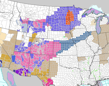
Here is the color code:
- Orange = blizzard warning
- Pink = winter storm warning
- Deep green = winter storm watch
- Browns = high wind warnings and advisories
- Magenta = wildfire danger
- Near black = freeze warnings
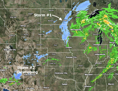
Radar at 10:20pm:
Storm #1 will be into Ontario by noon Wednesday. Storm #2 is just gathering in the southern Rockies and central Great Plains.
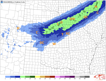
I don't see a reason to change the snow amount forecast from earlier.
Here is a more precise snow forecast with the timing included (11:10pm addition)
Snow until 6pm Wednesday
Snow from 6pm Wednesday to 6pm Thursday


Comments
Post a Comment