
Update on Winter Storms #1 and #2; Time: 3:45pm
Here is a map of National Weather Service Warnings,
Watches, et cetera for
Storms #1 and #2

Here is the color code:
- Orange = blizzard warning
- Pink = winter storm warning
- Deep green = winter storm watch
- Browns = high wind warnings and advisories
- Magenta = wildfire danger
- Near black = freeze warnings
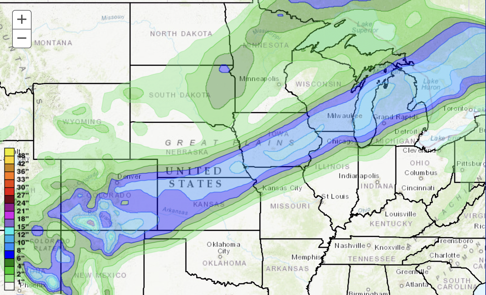
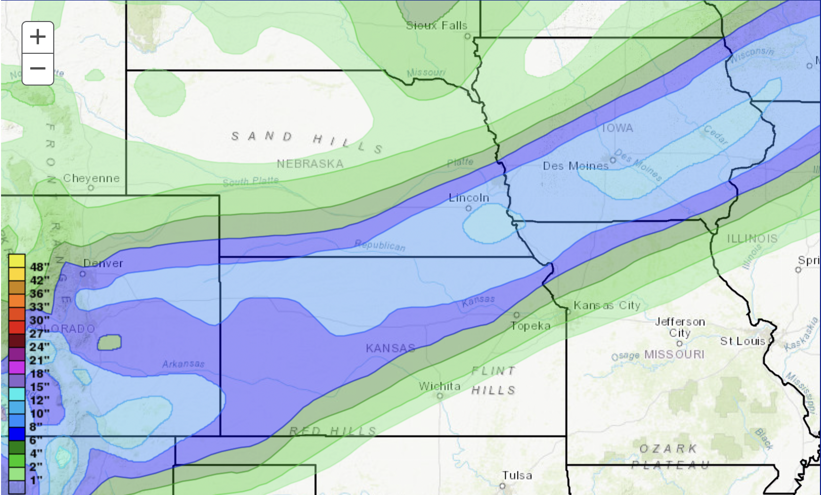
Below is the map of snowfall over the next 72 hours. The amounts from South Dakota northeast across Minnesota and western Ontario represents storm #1. The band of snow from the Four Corners to Lower Michigan is storm #2.
Storm #2 at noon on Wednesday, forecast radar.


Finally, the current (3:40pm radar)


Comments
Post a Comment