
Ice Storm Update
While this will not be a massive ice storm, it will cover a large area and will cause major traffic difficulties. The forecast is valid from now until 6pm Wednesday.
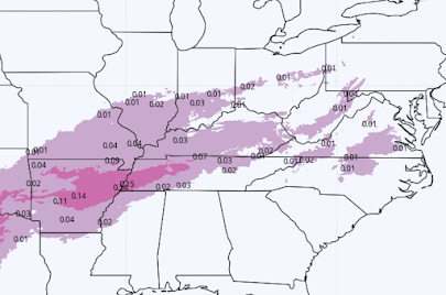
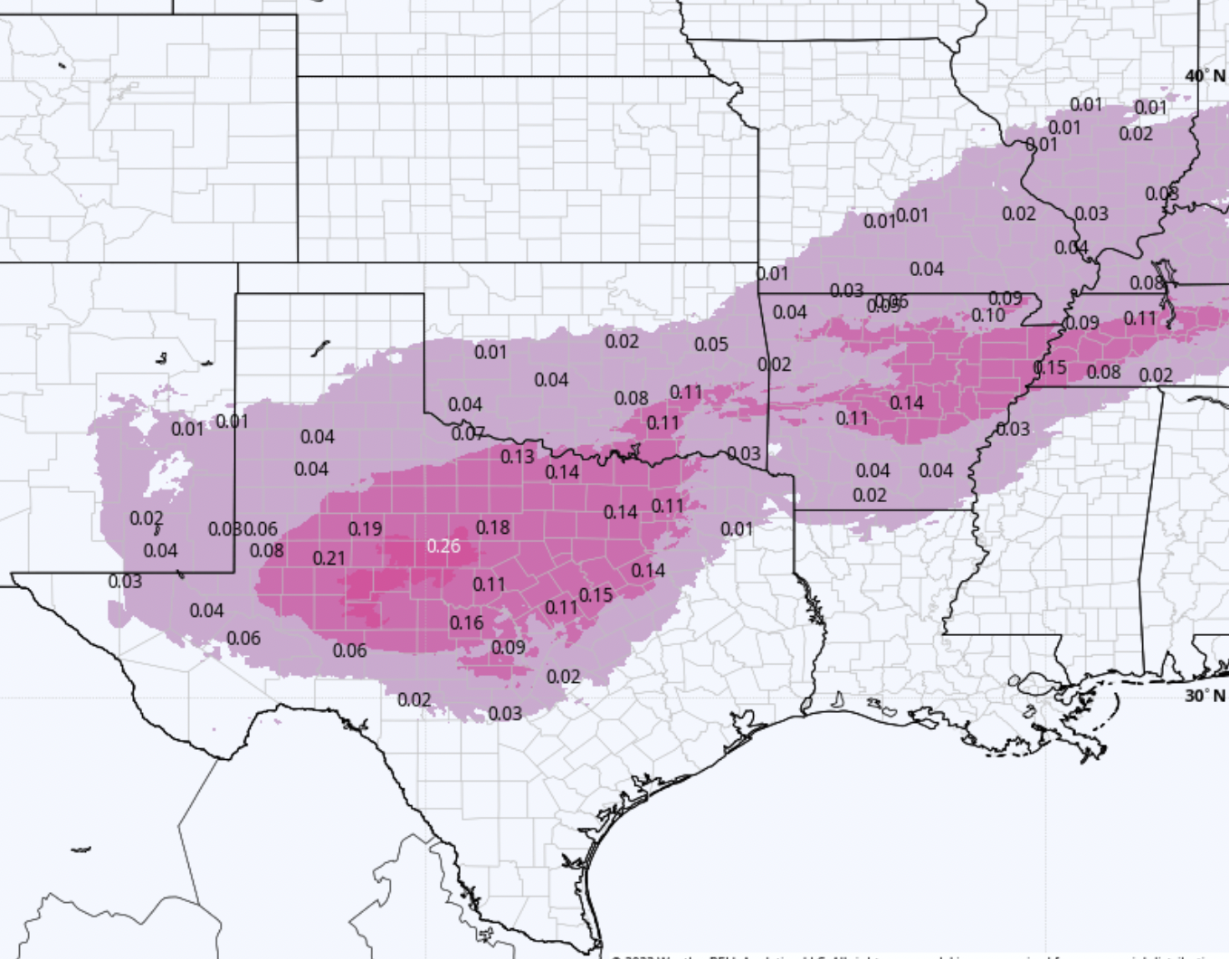
 The worst ice accumulation will be near and west of the Abilene - Sweetwater area and may affect I-20.
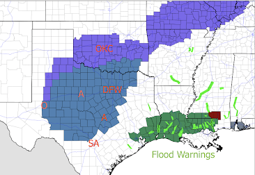 Color code:

At this point, I do not expect major areas of power outages but there is always the possibility of isolated power issues.
UPDATE: Here are the National Weather Services storm headlines as of 4:35pm.

- Dark cyan: winter storm watch for the freezing rain.
- Purple; winter weather advisory (lesser condition).
- Green and maroon: flood warnings.
Comments
Post a Comment