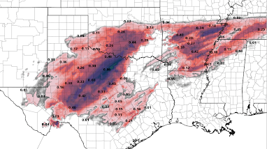
8:40pm Ice Storm Update
Right now, the above looks like a faithful depiction of additional freezing rain. The amounts may be a bit high in places, but overall, pretty good.
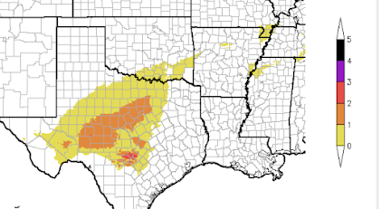
The NWS's forecasts, before the above model came out, translated into the values (below) on the Sperry-Piltz Ice Storm Index.
A detailed explanation of the Index is here. The NWS warnings, etc., in the posting below are unchanged.


Comments
Post a Comment