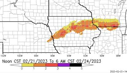
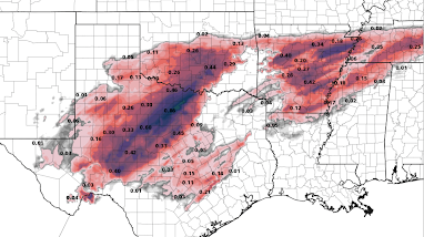
Ice Storm and Near Blizzard Conditions Forecast - Updated 10a Saturday

Here are storm highlights. While there will be widespread heavy snow (defined at 4" or more), it will combine with high winds and low visibilities over parts of eastern Kansas Saturday night and Sunday. Like the snow, there will be widespread freezing rain south of I-70 in Kansas and south of U.S. 50 in Missouri and along/south of I-64 in Illinois. With several days of winter cold following the ice storm, it will be important to care for people who have lost power. Over Kansas, winds are forecast to gust to 35 mph in places. In Ozarks are forecasts to be lighter but accumulations of freezing rain are forecast to be greater which will also be the case farther east into the Ohio Valley. If you live in these areas, it is important to begin preparations for potential power outages. The Sperry-Piltz Ice Storm Index (SP) is below. It has been upgraded to purple (level 4) in the past few minutes over parts of east central Kansas and from southeast Missouri into so...