
Drought Update and Rainfall Outlook
Here is the latest Palmer Drought Index with data as of November 21. 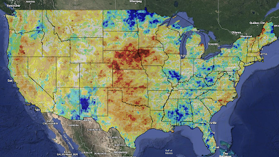 The darker red areas indicate more severe drought. The more blue an area, the wetter it is.
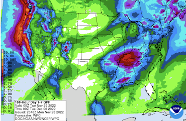

Here is the NWS's precipitation amount forecast for the next seven days.

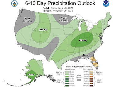
Here is the NWS's 6 to 10 day precipitation forecast.

While this rain will be helpful in the West, it will be unhelpful in the Ohio Valley which is already too wet.
As the Palmer Drought Index shows, the severe drought from Nebraska and Iowa south to Texas is where ran or snow is needed the most and five-day amounts are generally light to moderate in that region.
And, for days 11-15, here is the European model (the best in the world, but there can be large variations 


between the forecast and the actual amounts that far into the future).
On a related topic, there are indications in both the data and the models that a prolonged cold wave may move into the Lower 48, especially the eastern half, by mid-December. Please keep that in the back of your mind for planning purposes.


Comments
Post a Comment