4:10pm CDT Tornado and Tropical Storm Update
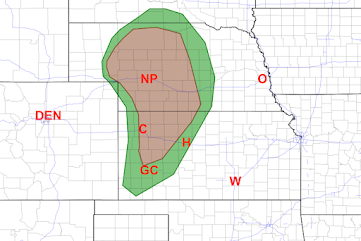
The area in brown has a significant risk of tornadoes until around midnight. There is also a risk of hail up to 3" in diameter.
The National Hurricane Center has issued tropical storm warnings (blue) from the Virginia-Deleware
Tomorrow, there is a risk of tornadoes near and east of the path of developing Tropical Storm Ophelia.
border south to Wilmington, NC.
Peak sustained winds are forecasted to be about 55 mph with this storm with stronger gusts.
 |
| (S) = potential tropical storm. S = tropical storm (winds in this case 40-60 mph) (D) = post-tropical depression |
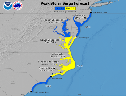
There is also a storm surge warning for the area in yellow with a lesser storm surge in blue. Note the blue storm surge (1-3') extends north and south of the tropical storm warning.
Rains of more than five inches near the path of the of Ophelia may cause flooding.
I'll have another update tomorrow morning.


Comments
Post a Comment