
Today's Tornado Risk
On this first day of astronomical autumn, we have a springlike weather situation with tornadoes, giant hail and damaging thunderstorm-generated winds all possible.
Note: there are thunderstorms roaming parts of this area right now. This does not affect the forecast below which is for after 2pm this afternoon and evening.
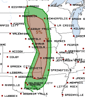 The brown area has a significant risk of tornadoes. However, there are indications the may be a somewhat higher risk in southern Minnesota and northern Iowa.
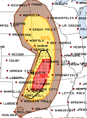 The hatched area is where hail 2 inches or more in diameter is forecast to fall. Elsewhere in the yellow area 1-2" hail is forecast with a significant risk. The red area is at an enhanced risk level.
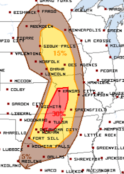 The yellow area has a significant risk of thunderstorm winds of 60 mph or stronger. The red area has an enhanced risk.
Tornado Risk

Giant Hail

Damaging Thunderstorm-Generated Winds

I will provide an update this afternoon.


Comments
Post a Comment