
11pm EDT Update on Ian
The storm continues to strengthen with a minimum pressure of 989 mb and maximum winds of 65 mph. I expect Ian will be a hurricane by sunrise Monday.
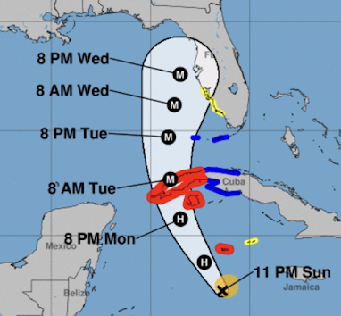 At 8pm Wednesday, the Hurricane Center is forecasting the storm to have maximum sustained winds of 120 mph.

Flooding rains will spread over most of the Florida Peninsula.
The National Hurricane Center's 3-day forecast is below and it represents a significant move to the east, similar to my forecast (immediately below this post). A tropical storm watch has already been issued for part of the coast between Naples and Clearwater Beach.

Here is storm surge information:

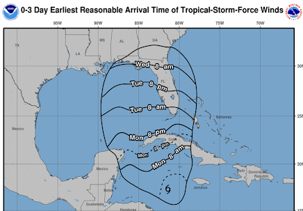
Below is the "earliest reasonable" time of arrival of winds of 40 mph or stronger. This means that people in the Tampa - Naples area should start preparations now if they have not been started already.

I'll have a complete update tomorrow morning.


Comments
Post a Comment