
5:05pm Monday EDT Hurricane Ian Update
Hurricane Warnings for the Florida Coast
Here is the current position of Hurricane Ian as shown by Grand Cayman radar at 4:30pm EDT.

Here is the National Hurricane Center's 5pm EDT track forecast and warnings. The storm currently has a central pressure of 965 mb and a peak sustained wind of 105mph (in red, updated at 7pm). The storm is strengthening and will continue to do so. The storm is forecast to strengthen to peak winds of 140 mph between Cuba and Florida.

- Red = hurricane warning
- Pink = hurricane watch
- Yellow = tropical storm watch
- Blue = tropical storm warning
- Amber = tropical storm force winds now
- Brown = current hurricane force winds
There is a very real danger of Ian slowing down near Tampa which would cause a severe storm surge (see map below).
This is a map of the forecast wind swath for Ian. One hundred mile per hour winds are likely at the mouth of Tampa Bay. Offshore, winds will be 130 mph.

There will be a highly dangerous storm surge in western Florida, especially in and around Tampa Bay. In places, the surge will be 10+ or higher with high waves on top of that value. See below for forecast storm surge.
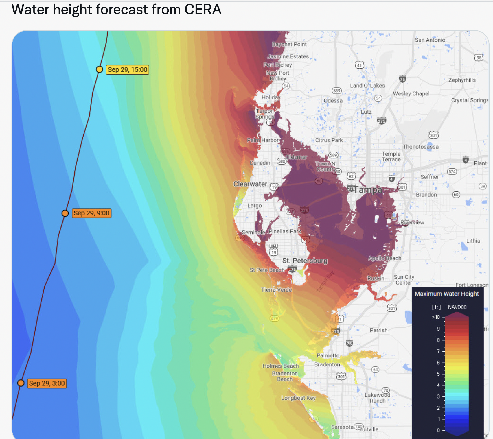 |
| Click to enlarge |
Here is the forecast storm surge in other areas.

Tornadoes are likely in this situation, especially in the yellow area Wednesday and Wednesday night.

Flooding rains are likely in Florida and may occur in coastal areas farther north.


Comments
Post a Comment