
Thoughts on Hurricane Ian as of 12:10pm EDT
12:10pm EDT update: The morning computer models are showing Hurricane Ian coming close to Tampa Bay and slowing down. If it comes to pass, this increases the risk of damage (and death or injury) from the storm surge combined with high waves. In addition, it makes rainfall amounts for greater than 15 inches possible in the central and southern Florida Peninsula.
If you live in the Tampa - St. Petersburg - Clearwater areas and are in a mandatory evacuation zone, please follow the directions of local authorities.
-- My Earlier Post --
Radar at Grand Cayman shows a much better defined eye this morning as of 10:53am.

As for the United States, here is the National Hurricane Center's (NHC) path forecast as of 11am. It looks very good to me.

- Red = Hurricane Warning
- Pink = Hurricane Watch
- Blue = Tropical Storm Warning
- Yellow = Tropical Storm Watch
NHC's wind speed forecast is forecasting Ian to reach 140 mph (Cat 4) when it is in the open Gulf southwest of Tampa. This means the storm has the potential to cause a considerable storm surge and well as extremely high surf.
Below is the preliminary storm surge forecast from NHC. Mandatory evacuations are now in effect in the Tampa - St. Petersburg Metro. Below is an updated storm surge forecast as of 11am.

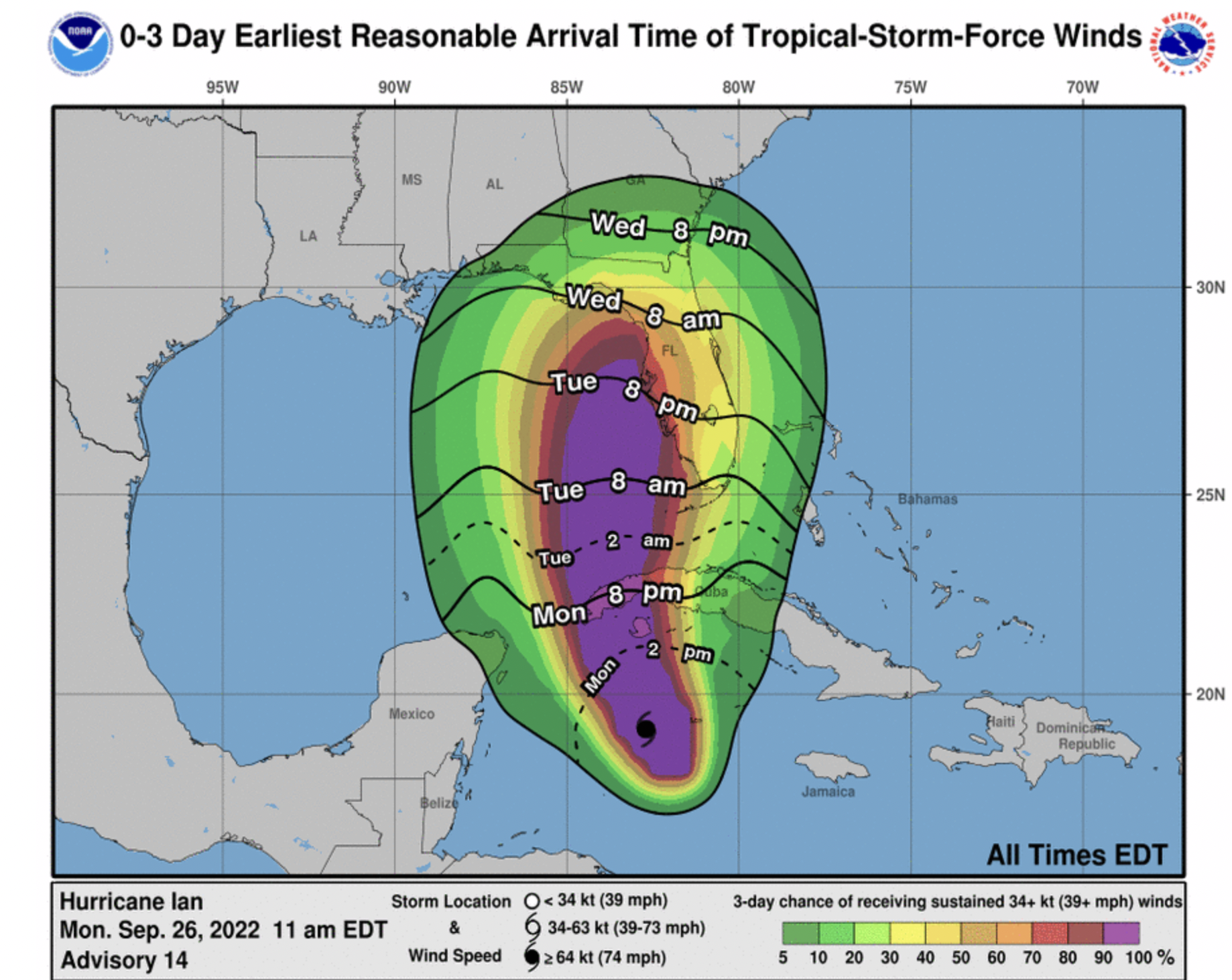
These are the times by which your precautions need to be completed.
Flooding rains are highly likely. There will be higher amounts in spots.

On Wednesday, there is an enhanced risk of tornadoes in the Florida Peninsula (yellow).

Tornadoes will be possible in northern Florida and Georgia on Thursday, so I recommend StormWarn for you, also.


Comments
Post a Comment