Tornado Threat Update, 7:25pm
7:21pm
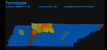
6:25pm "Multiple fatalities" reported from Montgomery Co./Clarksville.
The purple = rotation/tornado tracks as of 5:45pm.
Please ignore the symbols and focus on the purple tracks. Lighter = stronger storm.
Final Tennessee/Kentucky rotation/tornado tracks.
---
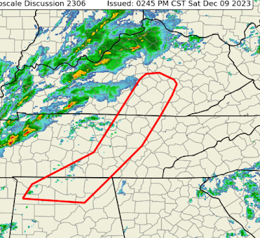
There is a continuing threat of tornadoes in the red-outlined area. In addition, the NWS SPC says that the purple area with have a rapidly increasing risk of tornadoes in the next couple of hours. Please follow me on Twitter @usweatherexpert. A strong tornado has passed through the north part of the Nashville Metro with considerable damage. There is one report of "injuries" but it is no more specific than that. This as of 5pm.
--- original posting ---
The red outlined area are where tornado watches will be issued shortly. This is a serious situation with tornadoes likely.
Special Note for Middle Tennessee and Nashville
There is a serious risk of tornadoes in Middle Tennessee the rest of the afternoon. In fact, the general weather ingredients for a tornado in the area have improved during the past hour. I urge you, your family and friends to monitor the situation the rest of the afternoon! Please foreword this if you believe it would be helpful.
Radar at 3:12pm.
Note the tornado-warned supercell thunderstorm to the west southwest of downtown Nashville.


Comments
Post a Comment