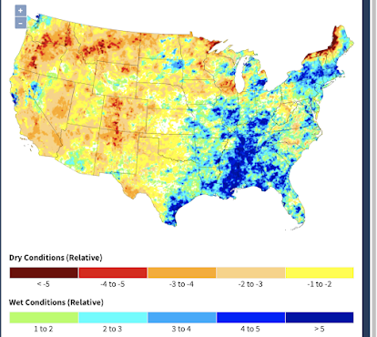
Here is the updated Palmer Drought Index with data as of the 16th.
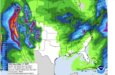
Note there are now a few small areas of blue (wetter than average) in California and Nevada! The forecast precipitation for the next seven days calls excessive amounts along the West Coast.
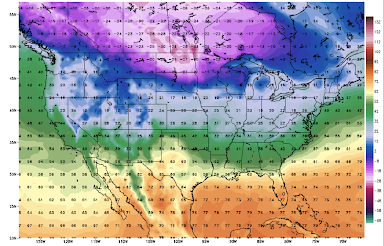
However, there are indications that the pattern will change around January 1. Below is a map of forecast high temperatures on New Year's Day.
The extreme cold that has been bottled up in Canada will finally move south and it looks like it may stay a while.
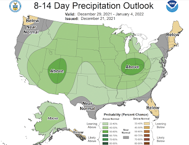
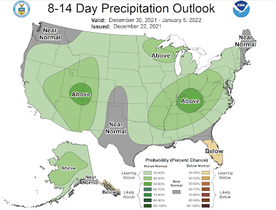
The 8-14 day precipitation outlook (published Dec. 21) is forecasting above normal in the Great Plains after two months of well below normal rainfall.
Here's the problem: if we have a trend to colder weather combined with above normal precipitation (snow), the supply chain issues we have seen across the nation will likely worsen. Stay tuned.
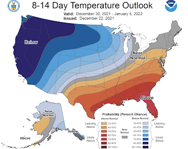
Update: Here are today's 8-14 Day Outlook. There are a couple of changes worth discussing.
This new set of forecasts agrees pretty much with the trends I discussed above. For the first time this season, the arctic air will get as far south and east as New Mexico, northern Oklahoma and Michigan. Once it sets in, it will probably stay a while.
If one combines the more extensive article air with above normal precipitation = a lot of snow. That heights my concern about additional supply chain and electric power supplies issues.


Comments
Post a Comment