
Winter Storm Forecast for New Year's Weekend
Updated: NWS watches and warnings as of 10:25am.
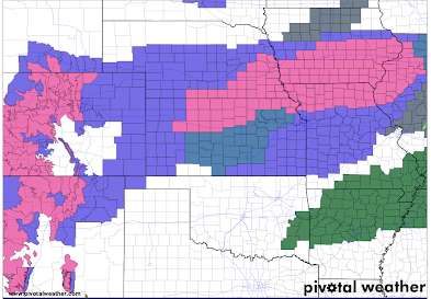
- Pink is winter storm warning.
- Deep green is a winter storm watch.
- Purple is a winter weather advisory (lesser condition)
- Green is a flood watch.
Here is the forecast snow accumulations.
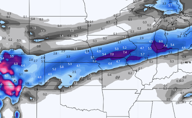 |
| Click to enlarge |
I'm still concerned there are some areas between I-70 and I-80 could have amounts a little larger than what is forecast here but this is the best forecast I can come up with at this time. Over southern Kansas and northern Missouri the snow will occur toward the end of the event.
Sleet/Ice Pellets
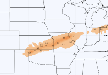
Snow amounts will be cut a bit by the considerable amount of sleet forecasted to fall.
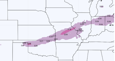
Freezing rain is what causes power failures, trees to fall, and roads to be incredibly hazardous. I don't believe there will be sufficient accumulations for power failures or tree problems.


Comments
Post a Comment