
The Extreme Cold Air Is Running Ahead of Schedule
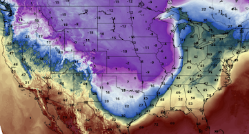
Here is the location of the leading edge of the extreme cold as of 6pm. Denver International Airport's weather station set a record for the biggest one hour temperature drop, ever (42° to 5°F) as it passed through.
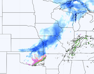
 The darkest blue = very heavy falling snow. From Wisconsin to Missouri, there could be blizzard conditions.
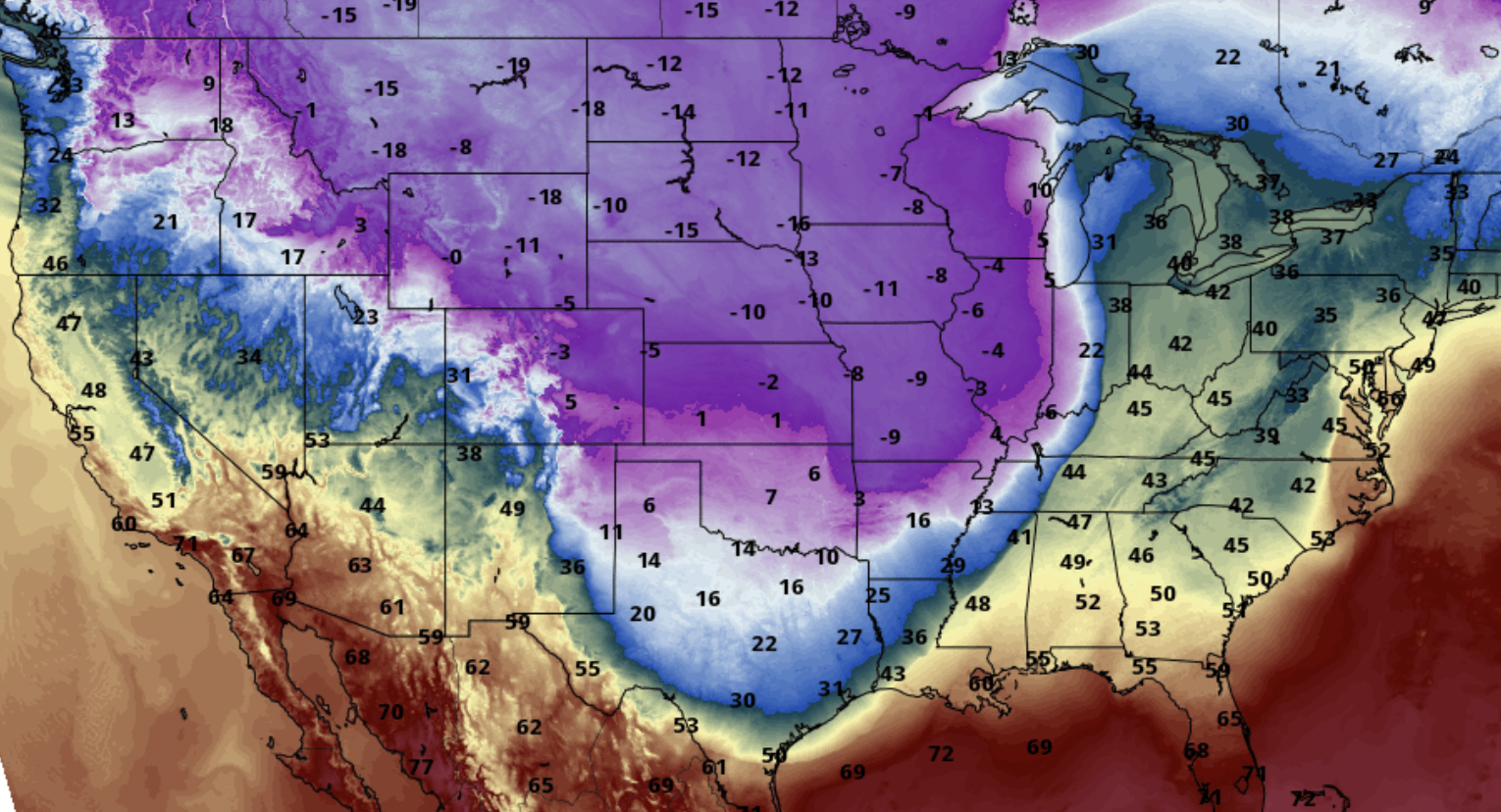
Below is the position of the cold air as of 6pm CST.
 Note: very light snow and drizzle/freezing drizzle do not show up on radar.
Below is the forecasted position of the cold air at 7am.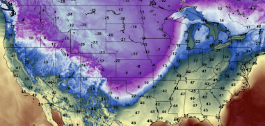
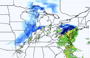 Snow will extend from Lake Superior to Oklahoma. A second area of snow, heavy in places, will develop over Maryland, Pennsylvania and will move into New York.
And, the forecasts for 5pm Thursday.

Weather conditions (winterized radar) as of 6:32pm.


Below is the forecast radar for 7am. Note the freezing rain (icy conditions) in Oklahoma and far northwest Arkansas.

At 11am CST, two areas of winter precipitation develop.

Temperatures
Weather Conditions


Comments
Post a Comment