
11:40am Complete Winter Storm Forecast
Let's begin with temperatures.

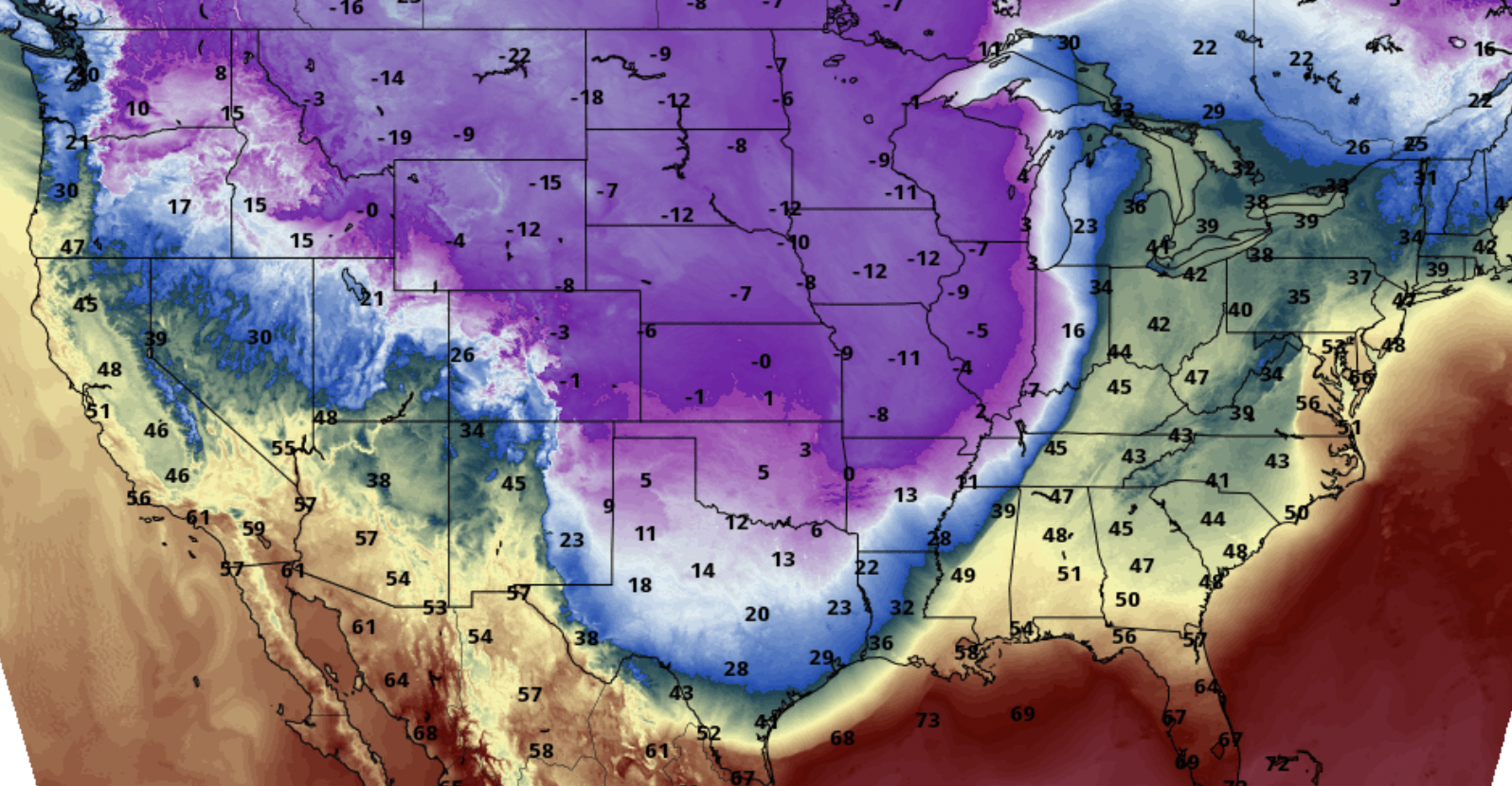
3pm Forecasted Temperatures
9pm Forecasted Temperatures
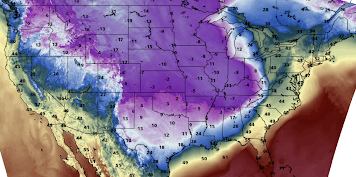 I included this because it is when single digit temperatures reach the Rio Grande River. Forecast wind chills are immediately below.
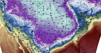 By this time, wind chills will have dropped to zero or below along the Rio Grande and will continue to fall the rest of the morning. This will create a humanitarian crisis due to the huge number of people outdoors and exposed to the extreme cold.
 The darker the blue, the heavier the snow. Chicago's O'Hare and Midway Airports will be seeing major cancellations in addition to the major delays now occurring. Some areas in the Midwest will be experiencing blizzard conditions.
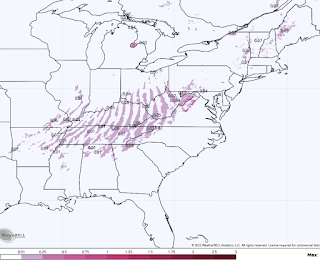 The "banding" from Arkansas to Pennsylvania is an artifact of how the model computes this. The area of freezing rain should depicted as a continuous area of precipitation, not as bands. Regardless, the roads in that area will become extremely hazardous due to icy conditions. There will also be areas of icy roads in New York and New England.
10am Temperatures

3pm Forecasted Temperatures

3am Friday Forecast Temperatures


Precipitation
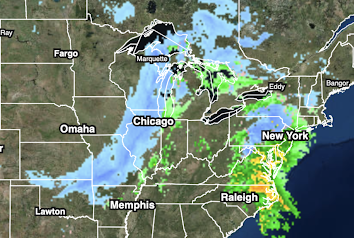
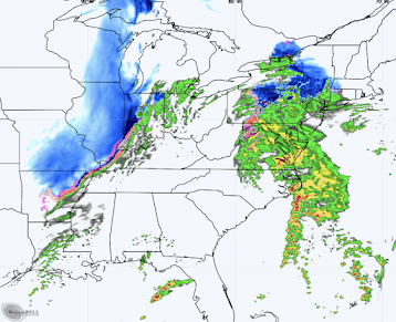
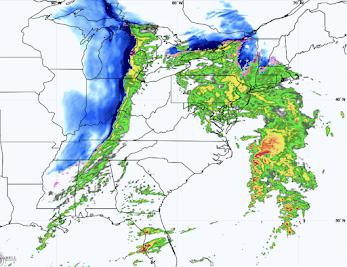
Here is the current radar as of 11:32am CST.

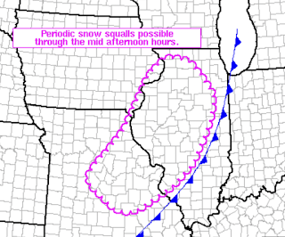
The NWS is predicting snow squalls with blizzard conditions between now and 4pm in the outlined area.

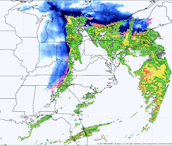
Forecast Radar for 4pm CST.

The snow in Pennsylvania will move into Upstate New York. The pink areas will be experiencing ice.
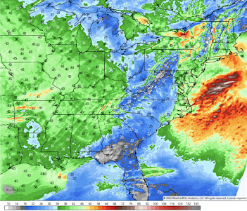
 If the computer model is right, blizzard conditions will extend from Lower Michigan to the Ohio-Indiana border area and south into northern Mississippi. It will also be snowing or icy into New England and Upstate New York. Note the thunderstorms in Florida.
 The high winds, combined with heavy snow, will create blizzard conditions in many areas. The winds will rapidly increase in the Northeast overnight which will cause power failures and severe lake effect snows. As of this moment, about 35,000 people are without power in Oklahoma.
 Freezing Rain Now until Midnight
8pm Forecasted Radar

Midnight Forecast Radar

Peak Winds Between Now and Midnight

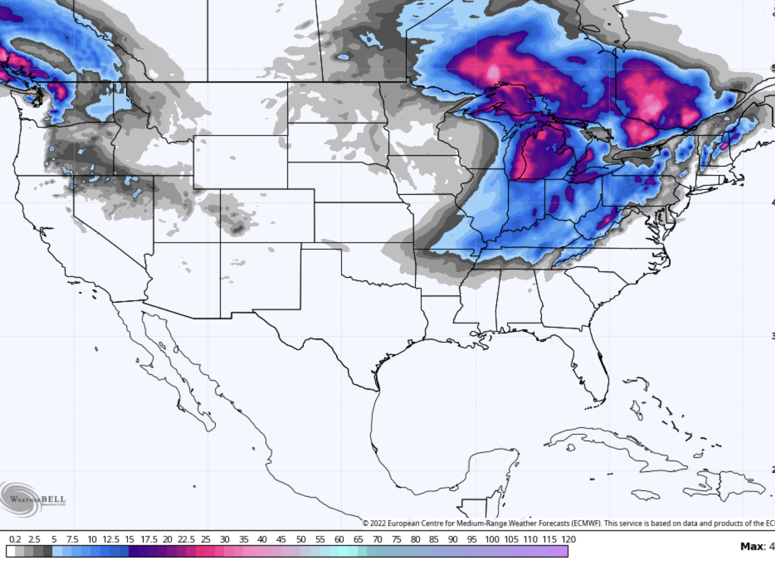
Below is the forecasted snow from noon today to noon Friday.

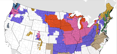
Finally, here are National Weather Service onshore Warnings and Advisories as of 11:40am.

Color codes for winter storm info:
- Orange = blizzard warning
- Pink = winter storm warning
- Dark green = winter storm watch
- Purple = winter weather advisory (a lesser condition than a warning)
- Gold/Brown = high wind forecast
- BlueGray = extreme cold warning
- Purple = ice storm warning.
Please note: I have spent an incredible amount of time on this winter storm since December 8 and I have to take a break for a few hours. Please put this information to good use.


Comments
Post a Comment