
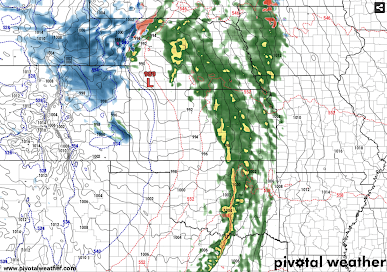
Major Storm: Forecast Radar for 6am Tuesday
A major storm is going to affect the central third of the nation on Tuesday. Using the forecast radar for 6 am -- keeping in mind that things will inevitably shift a bit -- please take note if you live in these areas or are planning to travel.
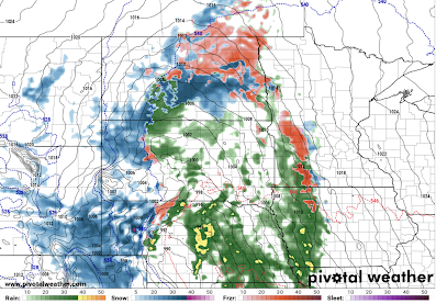


Starting in the north, the reds are freezing rain -- with icy conditions likely. The freezing rain may extend as far south as Omaha and most of western Iowa.
Heavy snow and/or blizzard conditions will occur from east central Colorado into southeast Wyoming and the Nebraska Panhandle. Those conditions will extend north and northeast during the day.
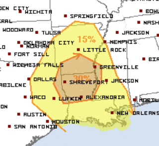
Yellow are areas of thunderstorms. Severe thunderstorms are tornadoes are possible in the south central area later in the day and Tuesday night.

I'll update the weather situation between now and then.


Comments
Post a Comment