
Here It Comes! [Updated at 4:pm Wednesday]
Please make sure you are following my coverage on Twitter @usweatherexpert.
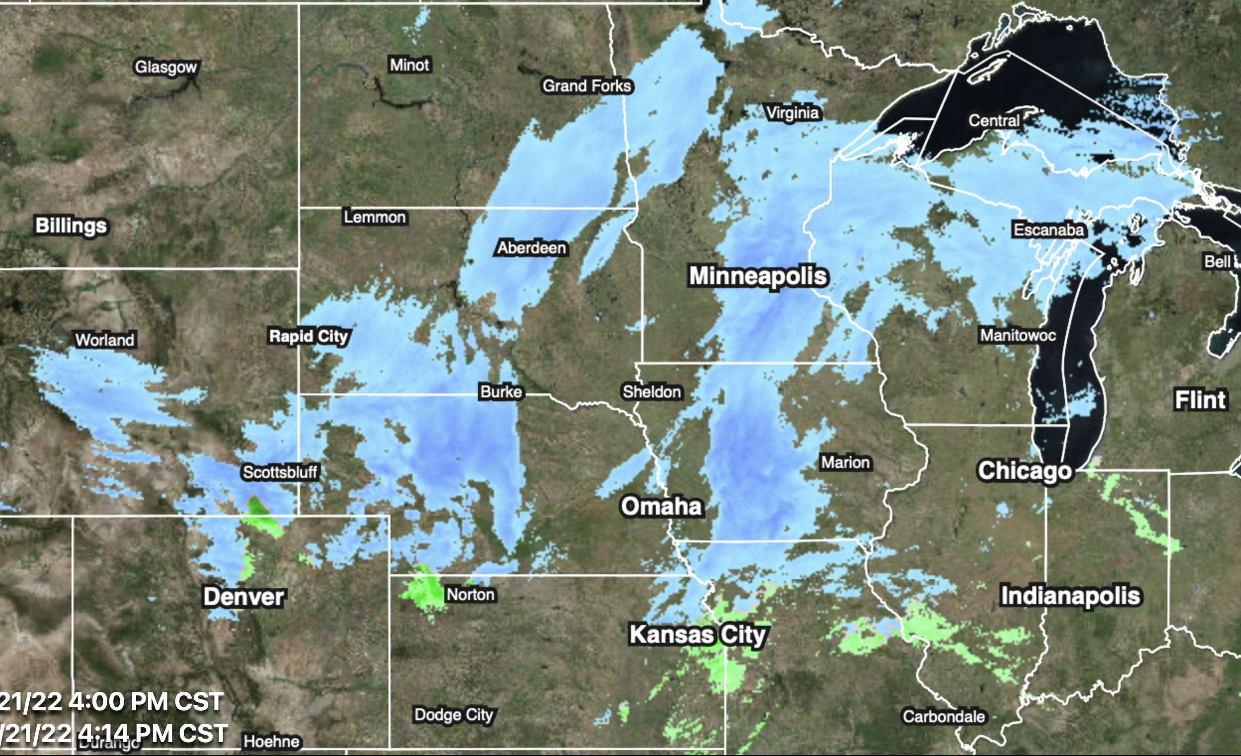
Winter precipitation as of 4:00pm.

Forecast position of the extreme cold at 7pm CST today.

Forecast position at 7am Thursday.

Predicted Radar (Precipitation) at 7pm This Evening

Blue = snow. Pink = ice.
Predicted Radar (Precipitation) at 7am Thursday

Predicted Radar (Precipitation) at 7pm Thursday

Do not try to drive through this storm or the cold air mass. If you fly through it, be prepared for flight cancellations or extended delays.
ECMWF model's forecast amount of snow now until 9pm Friday.

Snow forecast for 9pm Friday to 9pm Saturday.

Below are NWS watches/warnings as of 4pm CST Wednesday.

Color codes:
- Orange = blizzard warning
- Pink = winter storm warning
- Dark green = winter storm watch
- Purple = winter weather advisory (a lesser condition than a warning)
- Gold/Brown = high wind forecast
- Maroon = high wildfire risk
- Gray = dense fog advisory


Comments
Post a Comment