
Update on Cold Wave and Winter Storms; Additional Info Posted at 3:10pm
Snow Forecast From Now Until Wednesday

ColdWave Outlook
As far as the cold wave is concerned, my basic forecast has not changed. Here are the: Daily Forecast Temperatures for 6am CST from Monday to Friday.
 Wednesday
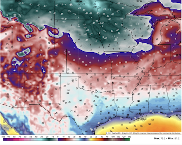 Thursday
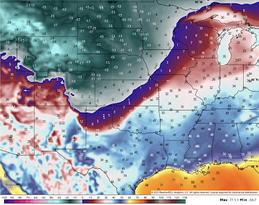 Friday
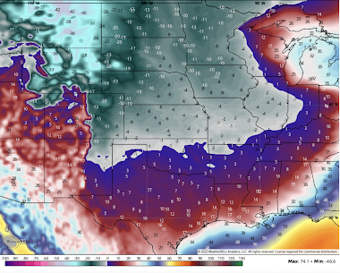


It must be emphasized that these are general approximation of where the snow may be the end of the week. Normally, I would not forecast snow locations this far out, but I am doing so because of the high level of interest due to Christmas travel.
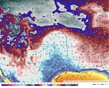
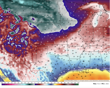
Monday

Tuesday


But, the winds will be high with the arrival of the Siberian air mass. Take a look at these wind chills for noon CST on Thursday and Friday.
Thursday Wind Chill at Noon

Friday Wind Chill at Noon

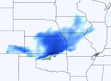
There will be accumulating snow with the arrival of the extremely cold air.
Snow Potential For Thursday at 6am

Snow Potential For Thursday at 6pm

Snow Potential For Friday at 6pm

It is quite possible there will be blowing and drifting snow in these areas.
Note: After the 23rd, there is the potential for another winter storm, perhaps in the Northeast and Middle Atlantic states.
I will continue to update on this dangerous weather situation.


Comments
Post a Comment