
Additional Information on the Predicted Cold Wave
We have updated forecasts and model information pertaining to the cold wave conditions that will begin next week and migrate from west to east across the nation. I believe this is worth reporting on two days in a row as some of the extended forecasts for particular locations that I have reviewed seem not to be sufficiently factoring in the strength of the cold air mass.

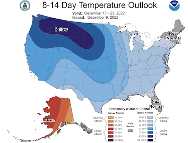
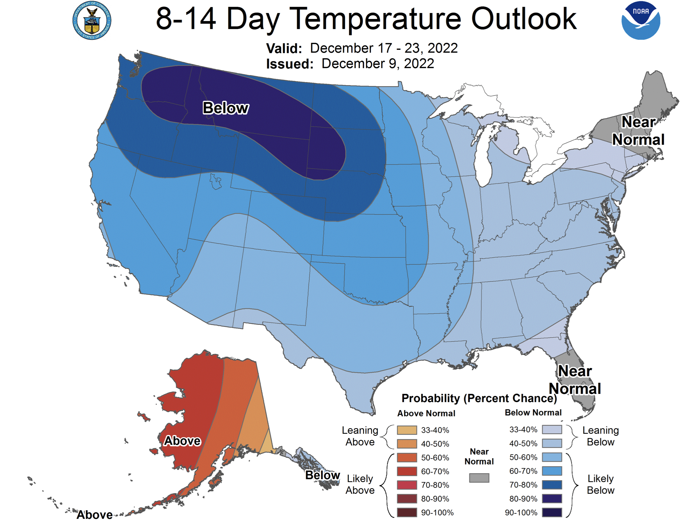
8 to 14 Day Outlook
Precipitation
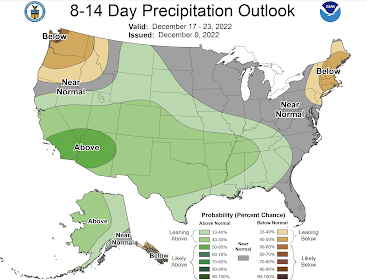 It is important to remember that above normal precipitation + colder than average weather = lots of snow. That is why I have emphasized these forecasts. Please prepare (ice melt, firewood, etc.) accordingly.
 If these forecasts are even close to being correct, the corresponding weather will cause a great deal of -- at best -- inconvenience. At worst, there will be blackouts, huge increases in energy costs (in Kansas our bills still have surcharges for the February 2021 cold wave) and transportation gridlock.
6 to 10 Day Outlook

8 to 14 Day Outlook
Temperature

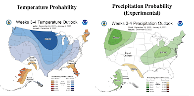
Weeks 3 and 4; December 24 to January 6, 2023

I would recommend monitoring the situation and acting ahead of the weather. I'll have another update early next week.


Comments
Post a Comment