UPDATED 3:20pm: Today's Tornado and Derecho Risk
UPDATE: The first watch of the day has been issued. Please follow me on Twitter @usweatherexpert.
-----------
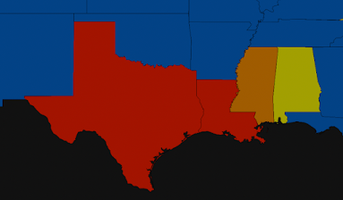
Instead of beginning with the forecast for later today and tonight, I'm going to start with the current power outage map. There are still 397,000 homes and businesses (900,000+ people) without power this region, most from Thursday afternoon and night's storms. There will be people still without power by Monday and Tuesday.
I bring this up because we are going to have similar storm conditions later today and tonight. Forecast for This Afternoon and Tonight
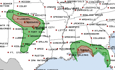
Tornadoes
These forecasts are from the NWS SPC. This is updated (3p) tornado outlook.
The brown areas have a significant risk of tornadoes.Derecho (Damaging Winds) Updated at 3pm
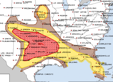
The red area has an enhanced risk of winds of 75 mph or stronger. The wind gusts of 75 mph or stronger -- will likely accompanied by power failures. However, I would put the hatched area as far north as Highway 400 in Kansas. Please see safety recommendations below.
SPC has also introduced an area of forecast 60 mph winds in Iowa.
Hail
The red area has an enhanced risk of hail 1" or larger. The yellow area has a significant risk. Where you see the hatching, the hail may be 2" or larger.
Safety Suggestions
- Call friends and relatives to make sure they are aware of the threat, especially if they live in a mobile home.
- Make sure you have at least three ways of receiving storm warnings.
- If you live in a mobile home, you may wish to move spend time with a friend or relative when a tornado or severe thunderstorm watch is issued.
- Ask yourself what you would need if you were without electricity for five days. In some areas it will be longer, but five days is a good planning target.
- If you have a chain saw, fill it with fuel.
- Check your tornado shelter. Make sure it has a couple of bottles of water and, if appropriate, diapers.
- Any essential foods or medicines should be taken care of immediately, well before the storms arrive.
- Have all of your devices charged but disconnect when you see the first lightning or hear the first thunder.
- Keep the kids in close communication.
- Bring in lawn furniture, trampolines or anything else that can blow away.
- Put the car in the garage.
I'll update in the mid- to late afternoon.
Additional suggestions from Liz Leitman at SPC:
- Pick any ripe tomatoes.
- Do laundry in case of extended power failures (quite likely in a derecho)
- Battery-operated fans for the same reason (it will be quite hot the next few days)
I will not be able to update as frequently as Thursday, but I will keep an eye on things. You can also follow more for more on Twitter @usweatherexpert.


Comments
Post a Comment