
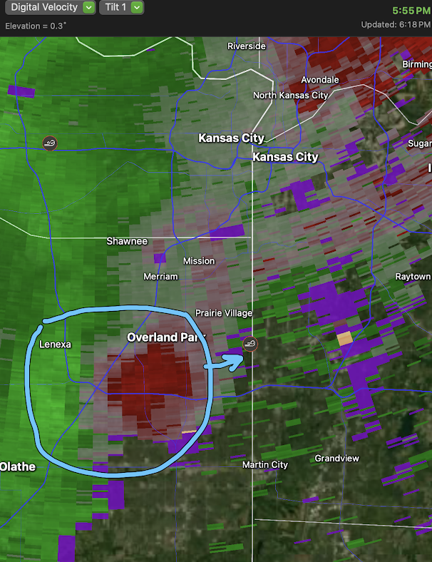
Downburst in Johnson County, Kansas
Earlier this afternoon, from Olathe, Kansas, I noticed an area where the rainfall was increasing rapidly as I looked north toward Lenexa.
 The NWS issued a timely and accurate severe thunderstorm warning calling for 60 mph winds -- they did a great job and people knew to get indoors (look at all of the lightning symbols) away from the wind and shock risks. Nice job, NWS!
 |
| I enhanced the photo so the rain streaks would be more apparent. The area I focused on is between the arrows. |
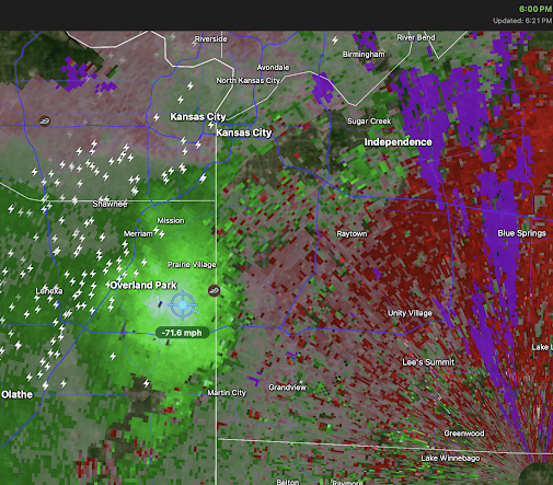
A few minutes later, the Kansas City Terminal Doppler Weather Radar -- which is specifically designed to detect downbursts -- depicted the downburst that formed over the Lenexa area of Johnson County. It moved east northeast into Jackson County, Missouri.

The "curly" symbol is for wind damage. Tree limbs were downed at the popular Ward Parkway Shopping Center.
The NWS WSR-88D measured wind gusts of 71 mph as it approached the shopping center. Typically, the radar overestimates wind speeds by about 10%. I imagine there was additional tree damage along the downburst's path. The electric utilities in the area have about 5,000 13,000 homes and businesses without power.


Comments
Post a Comment