
Unfortunately, The Forecast Was Correct

I took this photo just after 8pm. The tornado touched down ~100 yards in front of us and crossed K-15. The tornado is east of the road in the photo above. Our exact location is below. [Addition, NWS rated it EF-1.]

This tornado damaged or destroyed two homes northwest of Herington.
If you've ever wanted to know what it looks like when a tornado first touches down, it is seen below (taken through my windshield). It is about 100 yards in front of us. There is no visible funnel! That came 2-3 minutes later. In the background is the thunderstorm that produced the Andover Tornado.

There was a far worse tornado which struck far southeast Wichita (50-100 structures hit, per our mayor) and then hit Andover. You'll recall Andover was struck by an F-5 tornado on April 26, 1991.
 |
| The supercell thunderstorm that caused the Andover Tornado as seen from Durham, Kansas. |
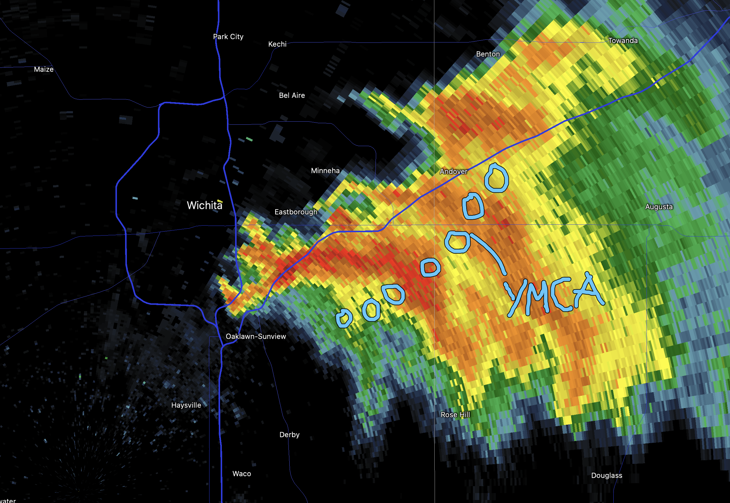
Here is the approximate path of the 2022 Wichita-Andover Tornado. The circles are rotation centers every four minutes.
Below is video from Donna and Jeff Taylor. Looking toward Andover from 127th and Pawnee, which is far southeast Wichita.
I'll have more on the storms tomorrow. Goodnight.
© 2022 Mike Smith Enterprises, LLC


Comments
Post a Comment