Posts

Showing posts with the label El Nino

Southwest Flood Outlook

Image
The heavy rain last week was accompanied by tornadoes, large hail and record flooding. More heavy rain is likely from the end of this week into early next week and, likely, beyond.  Below is are the forecast rainfall amounts for the next five days. Rivers are already high in the 4 Corners region so this heavy rain will worsen what has been record flooding in some areas. While forecasting beyond 5 days is dicey, here is the 6-10 day rainfall outlook. NOAA is portraying very high confidence of heavier than usual rainfall throughout the Southwest. This could turn into a record flood situation over a large geographic area. This is a result, in part, of the El Nino. As we, and others, have been saying: The only way to "fix" the terrible rain deficits in the Colorado River Basin is by flooding rains. This is going to be a problem throughout the winter! You will also recall the destructive tornadoes in the Southwest last week. More tornadoes are possible or even likely this week and...

The BENEFITS of a Major El Nino

Image
Three of thousands of news graphics about the current El Nino. A record El Nino (an area of warmer than average seawater along the Equator from South America west into the Pacific) is developing. So far, the media -- over and over -- has hyped the effects of the oceanic current.  But an article in the Bulletin of the American Meteorological Society correctly points out there is another side to El Nino occurrences. It looked back on the giant 1997-98 El Nino and tallied up the pluses and minuses. For the United States, The Negative Costs $1.7 billion (not adjusted for inflation to 2026) in losses $400 million in federal government relief $125 million for state assistance $700 million agricultural losses $ 70  million losses in sales of snow removal equipment $190 million loss to the tourist industry  189 people killed The Economic Gains $6.7 billion, reduced heating costs $5.6 billion, increased sales of everything from houses and other goods $380 million, reduced snow re...

5:05am HST: NHC Begins Tracking the Possible Tropical Storm in the Pacific

Image
Here is the first National Hurricane Center forecast for the low pressure system that may affect Hawaii. The tropical depression is expected to become a tropical storm (" S ") by tomorrow. The white area is the area of uncertainty regarding the center of the storm, not the storm's total effects. There is a risk of heavy rain over the islands, especially the Big Island (the Island of Hawaii) which has severely hit by Lala. Hawaii almost never is struck by tropical storms/hurricsanes except in years with moderate to strong El Nino's. This year has one of the strongest El Nino's ever.  Because I cannot assess the current status of the washouts in Hawaii and Maui, I'm not in a position to give advice with the exception of putting together a "go bag." Recommended contents are below, although they left off plenty of diapers, if appropriate.  Please follow local officials' recommendations.  Of course, I will update later today and tomorrow. 

Hawaii Hurricane Threat

Image
-- This is a Preliminary Forecast -- The graphic is an "envelope" of solutions from the best models in the world regarding the potential track of a tropical storm or hurricane. The highest resolution forecasts are the thick blue, red and yellow lines. The green is just showers between now and the storm's arrival on the Island of Hawaii. The ECMWF model shows the current area of low pressure reaching hurricane force as it reaches the islands. In this case, the stronger winds will be on the north side of the storm's center. There will also be a significant storm surge.  We have a strong El Nino and climatology shows that is when the Hawaiian Islands are most likely to be hit.  I expect the National Hurricane Center will begin official advisories later today. I just wanted to give m my readers a "heads up."

A Long Range "Heads Up" for the Southwest

Image
As the media has been correctly reporting: a record El Nino is developing in the east Pacific. Statistically, strong El Nino's cause heavy rains in the Southwest. If it is a record event, it is possible that widespread excessive rainfall will occur that will help refill Lake Mead, Lake Powell, et cetera.  However, there's no way the situation will materially improve without flooding. Please keep that possibility in mind.

The Drought Deepens

Image
The latest data shows reason for concern about the deepening drought in the West and its potential spread eastward. This week's drought data is discouraging. The severe drought from the Rockies to the Sierra continues to worsen as does the drought in the Middle Atlantic region.  Here is the forecast rainfall amounts for the next seven days.  In the West, the light rains will be of little help.  Our ability to forecast summer rainfall amounts at 8 to 14 days is marginal at best, but here's the latest estimate: While part of the western drought area is forecast to have greater than average rainfall, it is not particularly good news for two reasons. The first is that this is generally a dry time of year so more than usual rain isn't very much. Second, is the temperatures are forecast to be above normal so the evaporation rates will be high. I will periodically update this situation. 

Global Warming Hype

Image
This video is a view south from Hawaii. If you believe the global warming hype, this picturesque, pacific scene represents yet another mortal threat. The problem is that El Ninos (see below) have different effects on the weather -- no two are exactly alike. So enjoy a few seconds of tranquility and read the rest of this posting if you would like. We have no way of knowing accurately the intensity of El Ninos 150 years ago, as we just have just scattered measurements of ocean temperatures from ships. This is pure hype about global warming...err...cooling...err...warming or whatever Gore is pushing this week.  NOAA is only forecasting a 61% chance of an El Nino, let alone an extreme event. Their mean temperature forecast shows nothing extraordinary. You can see NOAA's forecast here . 

Guess at a Spring Tornado Forecast

Image
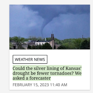
Several newspapers have run stories in the last few days pertaining to what type of tornado season (mild, bad) their readership areas might have this year. As you know, I do not post long-range forecasts on the blog because there seems to be so much interest -- I'm going to offer my thoughts on the topic as it pertains to Kansas as the Wichita Eagle  (screen capture above) ran one of those stories.  Based on some work I did a few years ago, Kansas tends to get more and worse tornadoes when El Nino/La Nina are neutral. This feature is known as ENSO and it is forecasted to be neutral this spring season. The spaghetti on the forecast graph (below) is the result of various oceanographic models' forecasts of sea surface temperatures in the equatorial east Pacific. Almost all forecast neutral conditions this spring. We will likely have an El Nino (positive temperatures > 1°C) by autumn.  The article also points out that high contrasts in soil moisture can promote tornadoes. ...

Out the Back Door this Morning

Image
It is quite uncommon for persistent fog to occur in Wichita. We have been foggy with hoarfrost frequently through January and now on the first day of February. Cloudier than usual weather is expected during a winter influenced by El Nino, but this has been rather extraordinary.