
Downburst West of Tulsa
Here is a shot of the rain shaft associated with a weak downburst at 5:40pm southwest of downtown Tulsa. 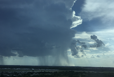 You can see Tulsa's Riverside Airport in the foreground. Downbursts, even of this intensity, are dangerous to planes when they land and take-off when they are over airports.
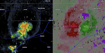

The radar at the same time shows the storm. On the left is the reflectivity image which shows how hard it is raining. On the right is the wind. The greens are colors showing winds blowing toward the radar and reds away from the radar. The peak gusts weren't all that high, about 35 mph.


Comments
Post a Comment