
Past 30-Day Rainfall and Forecast
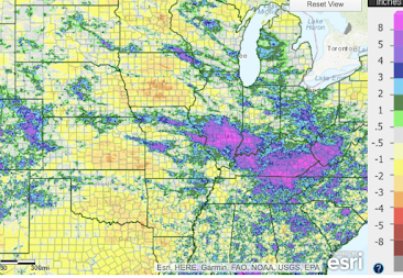
Because of data issues, I wasn't able to post this on the first as I intended. Regardless, here is the 30-day rainfall ending at 7am CDT this morning. The upper map is the rainfall amounts and the lower map is the departure from normal in inches. Below is the farm belt.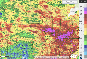
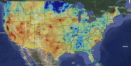
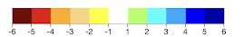 Brown is the driest. Dark blue represents the wettest conditions.


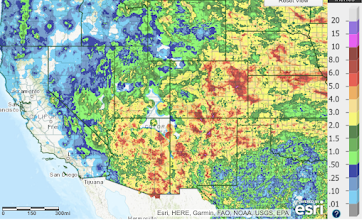
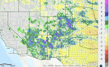
This year, the Southwest Monsoon rainfall is important and here it is.


UPDATE: Here is the latest Palmer Drought Index with data through July 29.

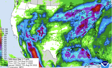
And, here is the forecast rainfall until 7am CDT on August 11.

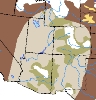
Below is the NWS/National Drought Center's estimate for the month of August. The white areas in the Southwest have been removed from the drought.

The green areas are forecast to be removed from the drought by the end of the month. The tan areas are forecasted to have significant drought improvement.


Comments
Post a Comment