
Meteorologists: Tornado "Tipping Vorticity"
 |
| Penn State University Meteorology |
It has long been suspected that "vorticity" (atmospheric spin) near the ground being tilted upward plays a significant, or even major, role in tornado formation (step 1, above). To my knowledge, this process has never been photographed.
This past Friday evening, Kathleen and I happened upon a tornado just as it was starting to develop eight miles west southwest of Hope, Kansas (below, target symbol), although it is being called the Tampa Tornado because it was closer to that town. I'll call it the Tampa Tornado from here, on.

.jpg)
Twenty-five seconds later (my camera kept the time), the dust organized around diagonal axis and began tilting in a counterclockwise direction motion relative to the ground.
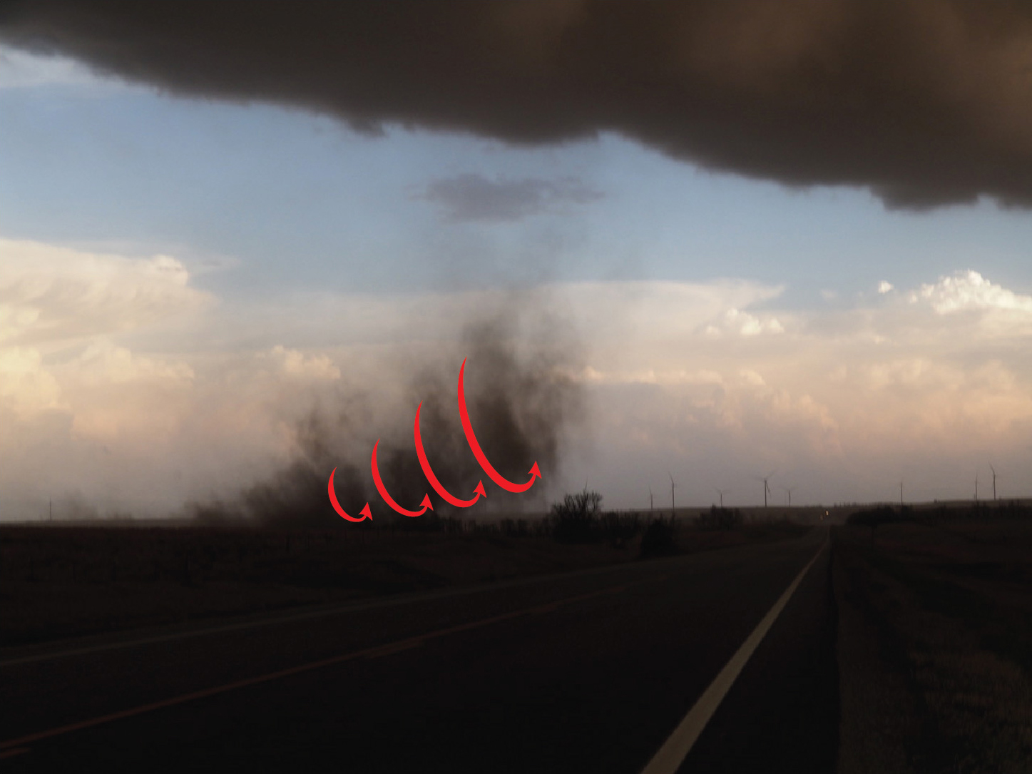
After an additional twelve seconds passed the tilting whirl had nearly become vertical.

At 7:59:14, the funnel cloud could be seen along with a more intense whirl in contact with the ground (arrows).

Finally, we have a well-formed tornado with a condensation funnel to the ground at 8:00:27. The tornado was later rated EF-1 intensity by the National Weather Service.
.jpg)
As the dust continued to rise and the tornado moved east northeast, we quickly lost sight of it.
I hope this is helpful to tornado research.
Thanks to graphic artist Trina Sanders.
© 2022 Mike Smith Enterprises, LLC


Comments
Post a Comment