
Posts

Showing posts with the label Wyoming

A High Wind Event Begins Tomorrow

Image
From KSNW Channel 3 News at 6pm, a graphic of wildfire locations (red). Weather satellites have the amazing ability to spot wildfires that is so good, it is often the first notification local official receive. KAKE TV tried an experiment where a satellite spotted a fire in a rural area. They called the fire department in that county and the dispatcher said, "We haven't heard anything about it." So, they went ahead and dispatched a fire truck and, sure enough... These are controlled agricultural burns.  Separately, here are the smoke plumes.  University of Wisconsin Most all of these in Kansas are prescribed burns as winds are light today. Those fires will be extinguished tomorrow before the winds increase.  Friday Important weather forecasts for the High Plains, Foothills and Mountains.  Here is the color code: Magenta = extreme fire danger.  Gold = high wind warning. In the foothills winds may exceed 100 mph.  Brown = high wind watch.  Dark turquoise ...
Wyoming and Kansas Report In: Wind Energy Collapsed During Cold Wave

Image
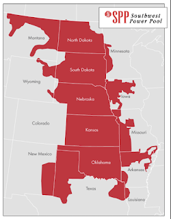
This report from Wyoming on its near blackout during the recent cold wave and winter storm.  Lee Boughey, a spokesperson for Tri-State Electric Generation and Transmission Association, said the nonprofit, which provides power to eight electric cooperatives across Wyoming, planned for the impacts of the storm as it approached.  They anticipated higher demand from member utilities in Colorado, Nebraska and Wyoming, and Tri-State prepared for wind energy resources to decline.  For safety, during extremely high winds, wind turbines will stop running and feather their blades. Icing also can cause turbines to stop running.  According to energy mix data from the Southwest Power Pool, as the storm began to move through Wyoming on Dec. 23, at 3 p.m., wind energy resources began to drop. Within 24 hours, wind energy resources were about 25% what they were prior to the storm.  They didn’t begin to rise again until Christmas morning.  To compensate for the decline i...

Updating Storm Potential

Image
The information I provided yesterday (scroll down) is pretty much still good. Two things: The yellow is where large hail is likely with scattered thunderstorms Wednesday night. Any thunderstorms that may form in south central Kansas between sunset and 10pm might also have the potential to cause damaging wind gusts.  Please Make Sure Friends and Relatives Are Aware of the Information Below Relative to normal temperatures for mid-March, there will be another cold wave from the 15th  through the 19th and, perhaps, another day or two after that.  The cold wave will lead to an  extraordinary snow storm  from the Front Range into, perhaps, southeast Wyoming and western Nebraska.  Here are probability maps of >3"of snow for each of the three days specified.  Friday afternoon to 6am Saturday I expect the snow to begin in Denver late Friday afternoon. 6am Saturday to 6am Sunday 6am Sunday to 6am Monday In the City of Denver, it would appear that snow ac...