Thanksgiving Travel Forecast - Updated 1:30pm Sunday
Here Are Forecasts For the Lead-Up to Thanksgiving:
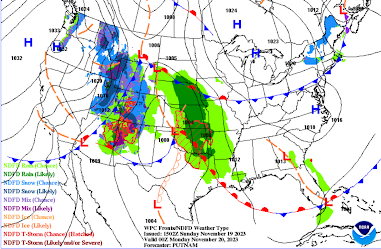
6pm Sunday
Note that Interstates 70, 80, and 90 will be affected by snow tonight as well as Interstate 15 southwest of Salt Lake City.
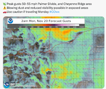
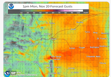
High winds are likely east of the Front Range and into southeast Wyoming along I-80.
These winds will affect Interstates 25, 70, 76 and 80.
6pm Monday
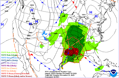
Widespread rain and thunderstorms will occur throughout the Mississippi Valley. Rain may slow flights at Chicago, St. Louis and Memphis. Update: Tornadoes, some strong, are forecast to occur from east Texas into far western Alabama late Monday afternoon and Monday night. I urge you read this forecast along with safety suggestions.
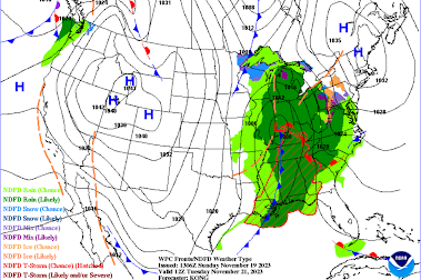
6am Tuesday
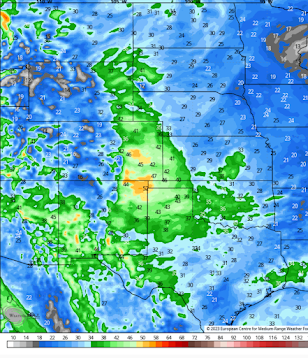
By Tuesday morning, the West will be dominated by a large high pressure system that will bring cold air south -- likely setting the stage for snow from Friday through Sunday (depending on location, see below). East of the Mississippi River rain will be widespread. There will likely be flight delays in Chicago and Atlanta. Small areas of icy roads may occur in parts of New York and central Pennsylvania with snow near western Lake Superior. Also on Tuesday, high winds with gusts to near 60 mph are likely along I-70 in far western Kansas and eastern Colorado as long as near I-90 in Montana.
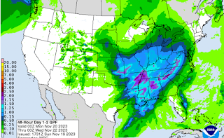
Below is a forecast of the amount of precipitation forecast between 6pm this evening to 6pm Tuesday.
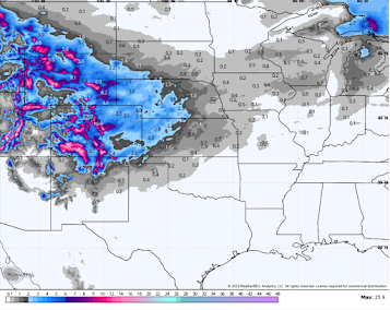
For planning purposes: Below is a very preliminary snow forecast for Thursday night through Sunday evening to give you a general idea of where snow is possible. This forecast is a blend of models.
There are individual models that are producing snow as far south as Norman, OK. I think that is unlikely but not impossible.
Of course, I will continue to update all of this.



Comments
Post a Comment