11:10pm EST Update on Tropical Storm Nicole
The National Hurricane Center says Nicole's maximum winds are now 70mph with the central pressure at 984 mb, which is a considerable drop from this morning. Here is the legend for the map:
There is a risk of tornadoes in the east half of the Florida Peninsula tomorrow and Thursday. There will also be areas of heavy rain that will cause flash flooding.
- Amber: the area of tropical storm force winds
- S = tropical storm
- H = hurricane
- Red = hurricane warning
- Blue = tropical storm warning
- Yellow = tropical storm watch
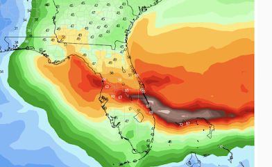
The area of tropical storm force winds (39 to 74 mph) is huge, which is why the exact location of the center of the storm is somewhat less important from a warning point of view. Below is a map of the maximum winds (regardless of time) predicted with the storm during the next five days. Note there is a narrow band of hurricane force winds going inland near Melbourne.
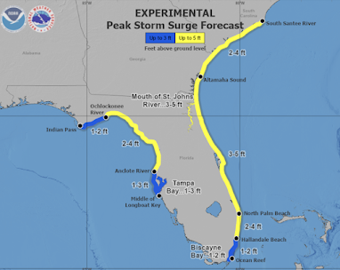
Below is the forecasted peak storm surge.
*FYI: I corrected the title of this post.


Comments
Post a Comment