Gaylord, Michigan Struck By Strong Tornado
NWS's Warning For This Tornado Was Inadequate
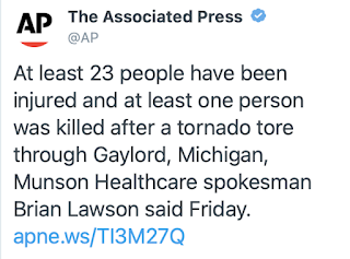
The date of May 20 is one of the infamous in tornado history. Unfortunately, we are going to have to add another tornado to the list -- the one that occurred this afternoon in Gaylord, Michigan.
 |
| 8:25pm Friday |
Update: At 11am pm Saturday, there are two fatalities, 44 injuries and one person missing according to the Detroit News.
While the damage reports are just starting to come in, the storm appears to have been EF-2 to EF-3 intensity as a rough estimate. I have not seen a report as to injuries. Note: NWS rated the storm EF-3 intensity -- a "strong" tornado.
 |
| Photos: Michigan State Patrol except for screen capture which is The Weather Channel's |
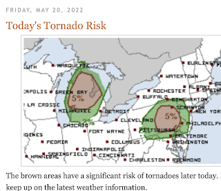
This morning's blog post included National Weather Service's (NWS) Storm Prediction Center's forecast of a "significant" (my term) tornado risk for northern Lower Michigan.
Unfortunately, the forecast and warning quality went downhill from there.
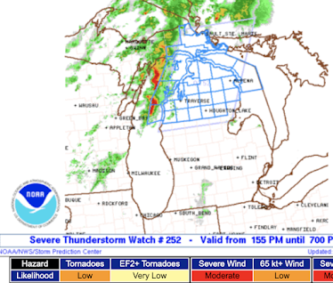
A severe thunderstorm rather than a tornado watch was issued. The chance of any tornado was rated "low" and the chance of an EF-2 or stronger tornado was rated to be "very low" (see lower left).
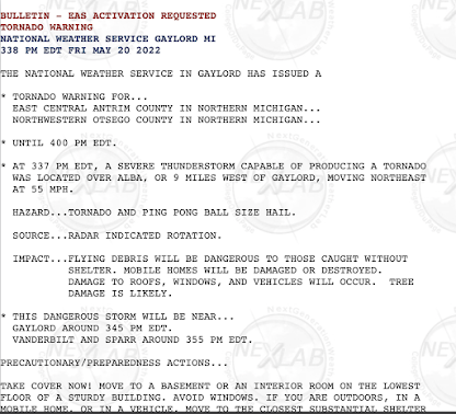
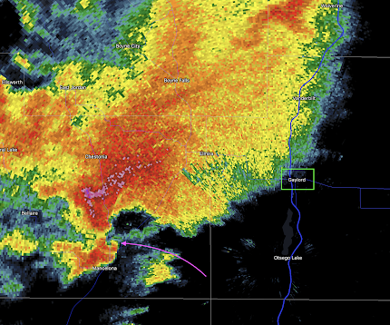
The warning of the approaching tornado was sub-par, also, if the report of the tornado reaching Gaylord of 3:45pm is correct. The tornado warning was not issued until 3:38pm (below) which amounted
to just seven minutes of lead-time in an obvious situation. This is less than the NWS's all-tornado average for 2012-2022 period of 8.4 minutes. Generally, and it was certainly the case this afternoon, the stronger tornadoes are easier to warn of than the weaker tornadoes.
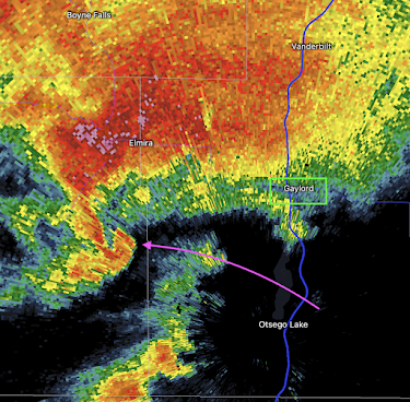
In my opinion, a tornado warning should have been issued upon the radar data available at 3:26pm. Since it takes one to three minutes to issue a warning (assume 3 minutes at 3:29pm), that would have given the town 16 minutes of lead time. Per research by Dr. Kevin Simmons, the ideal lead time is 15 to 18 minutes.
The "hook echo" (arrow) combined with the data from a special weather balloon launch at 3pm made this rather straightforward (for meteorologists: the 0-1km SRH was 233, well above the threshold of 175 and the SIGTOR was 3). Instead, the tornado warning was not issued until this data came in at 3:35pm. The tornado warning was sent three minutes later.
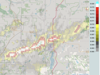
Here is the path of the tornado's rotation track.
From the rotation track, it appears the tornado struck the west and north parts of the city. It is utterly perplexing why the National Weather Service's tornado warning quality is considerably lower now than it was 15 years ago.






Comments
Post a Comment